A Very Old Store and a Vanished Wine House
The Store
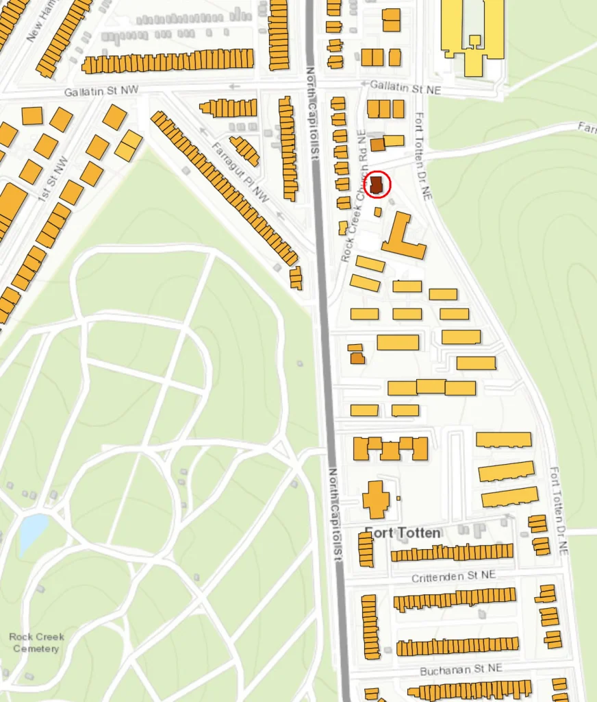
A few years ago, the Historic Preservation Office at DC Planning released their History Quest map, which provides ages and other pertinent info for almost all the houses and buildings in the District. It’s a wonderful resource, and I’ve used it many times over the years. The buildings are color-coded, ranging from pale yellow for more recent houses, to dark brown for the older ones. Take a look at the above portion of the map showing the Fort Totten neighborhood. A few shades of yellow and orange, but only one dark brown building (circled in red above). If you click on it, an information box comes up.
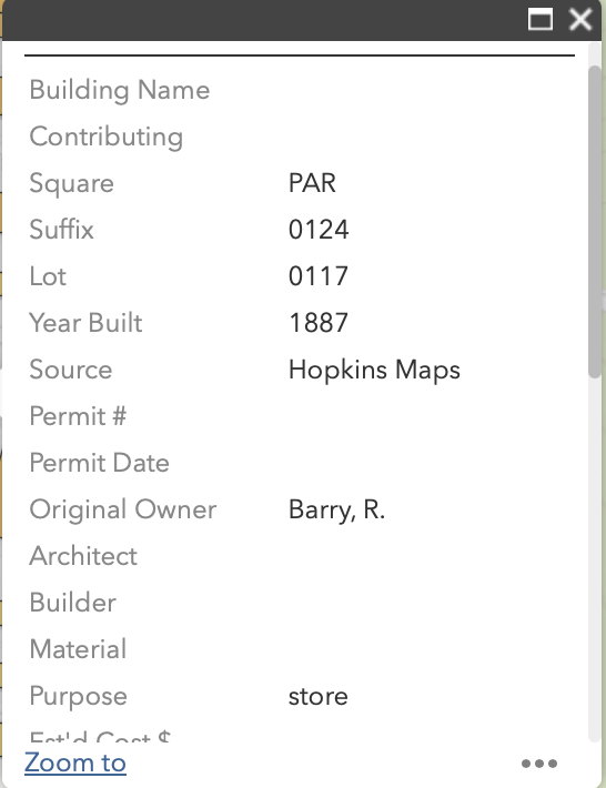
It gives the year built as 1887, the source being the Hopkins map. Below is a portion of that map:
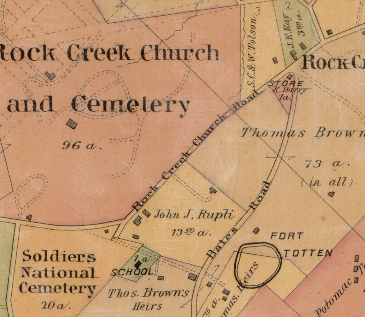
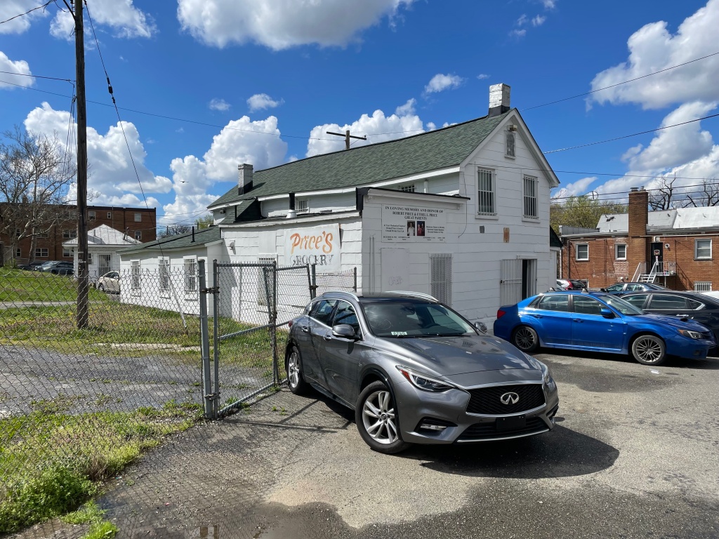
That house is identified as a store with one acre of land, owned by R. Barry. Today, there is still a store on that site, Price’s Grocery at 5018 Rock Creek Church Road NE. If you travel out Fort Totten Drive, you can see it on the left, in a gap between the brick apartment buildings. The build date of 1887 was only given because that’s when the Hopkins map was published. I thought the store might be older, so began to look up R. Barry. It turns out his name was Robert Barry, a Scottish immigrant, and he likely bought the acre of land in 1861 or so. In 1863, during the Civil War, the Federal Army assigned Pvt. Robert A. Hodasevich to draw maps of the defenses of Washington. Those maps are incredibly detailed and quite accurate. Here is the map of Fort Totten and the area around it:
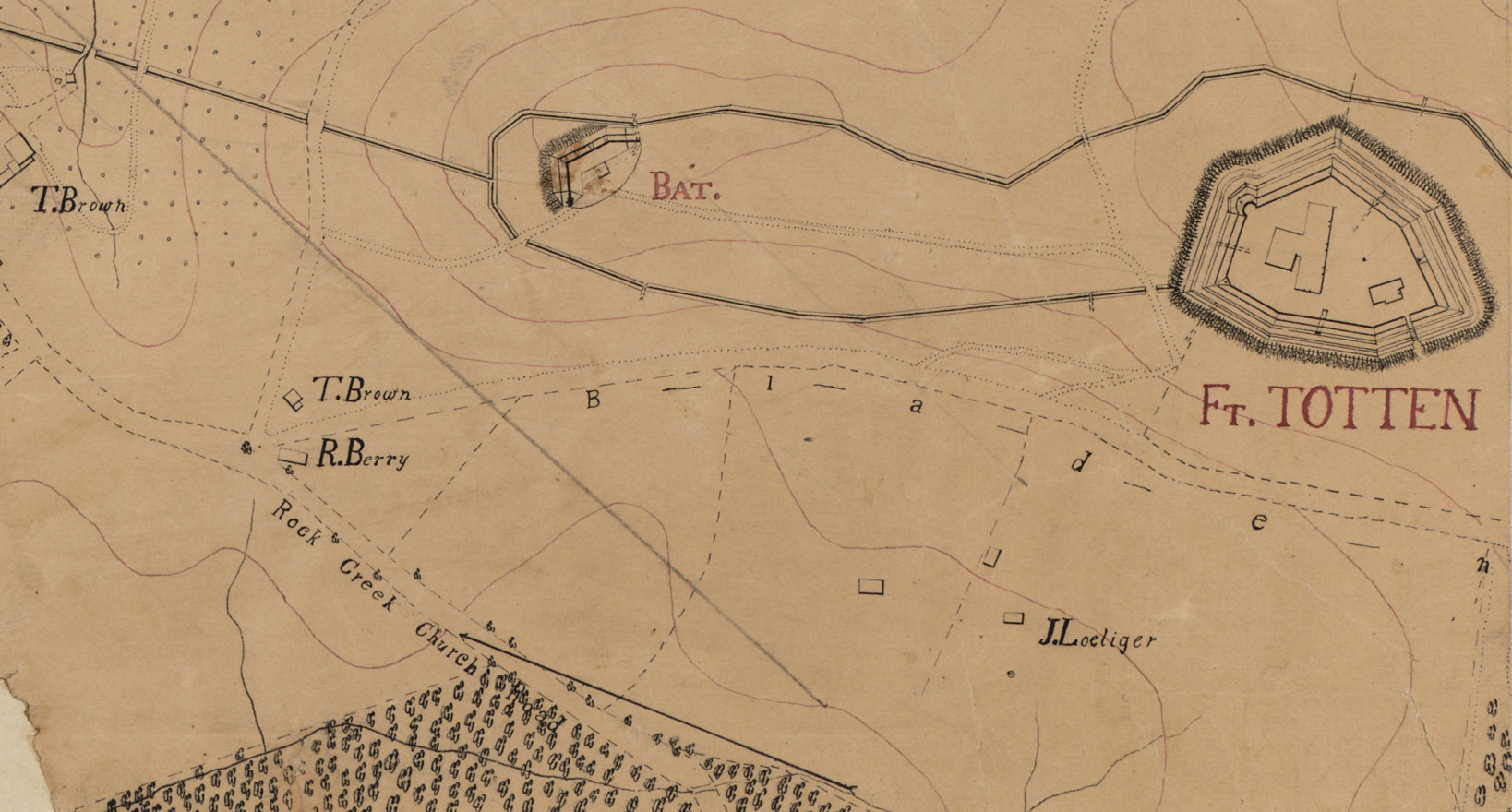
It’s clear from the map that Robert Barry (misspelled Berry) already had a house there in 1863. But was it also a store? Indeed it was, as can be seen from this 1864 tax assessment list. Robert Barry is listed on lines 9 and 10.
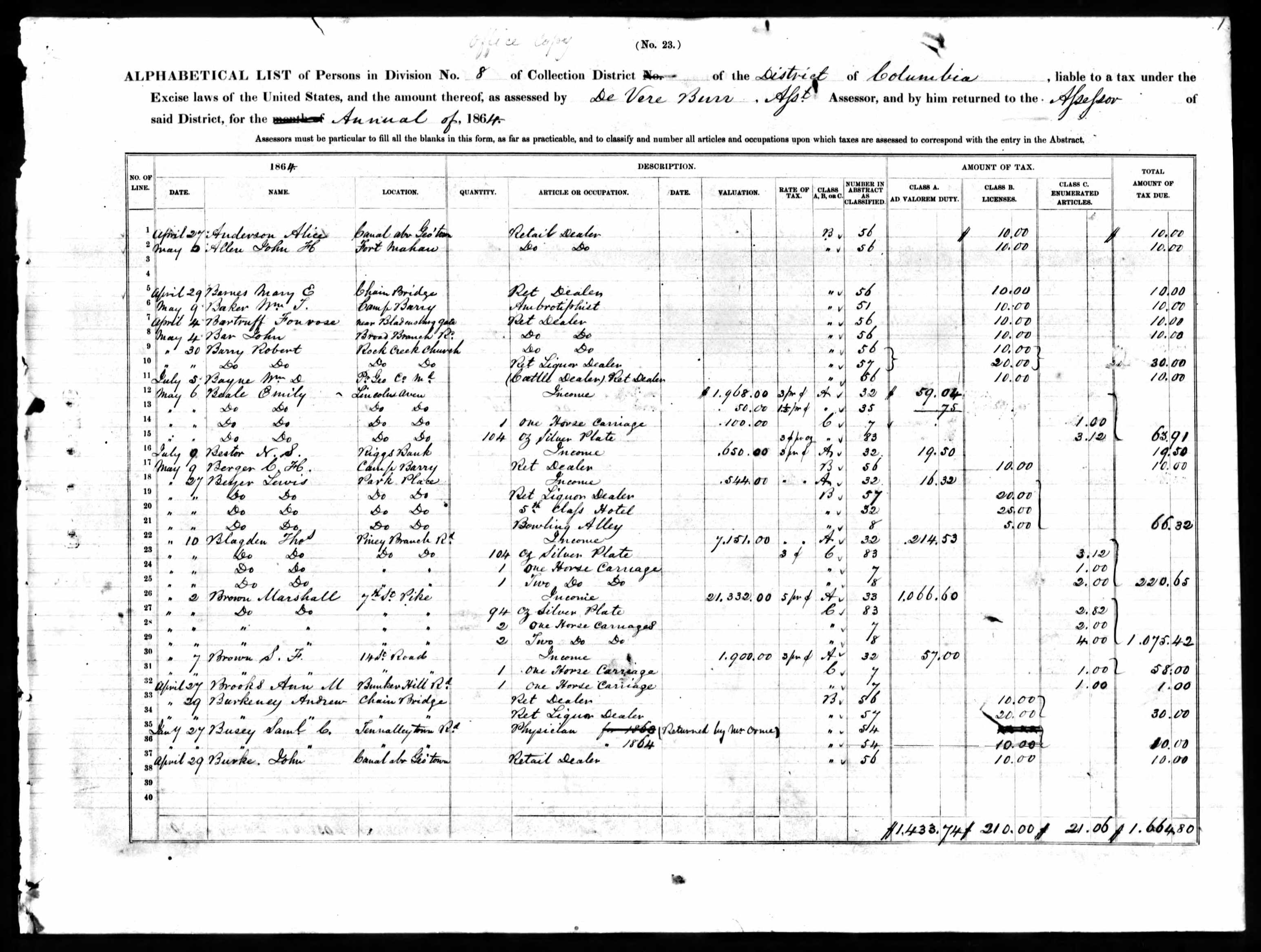
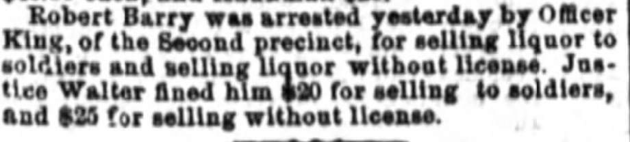
Not only is Robert Barry listed as a retail dealer, he also is a liquor dealer. Sometimes that could get him in trouble, as you can see from this 1865 newspaper article:
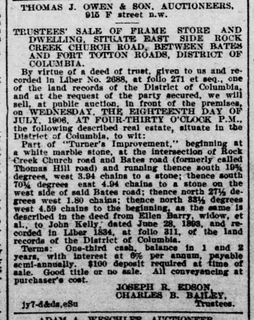
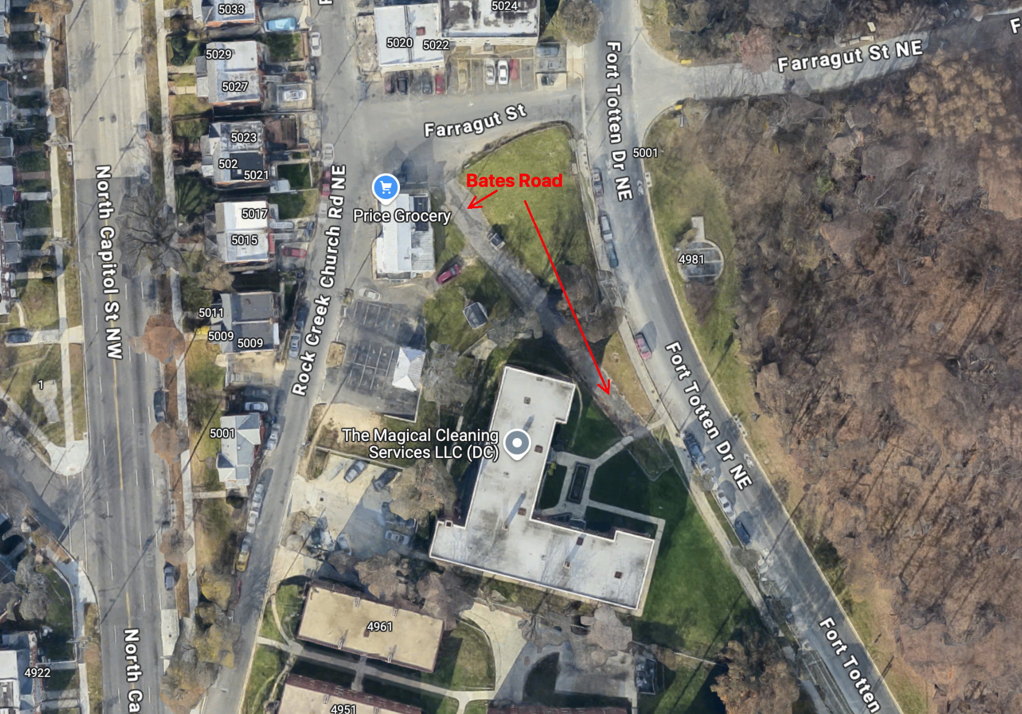
The store was in a very good location, at the intersection of Rock Creek Church Road and Bates Road, both important Washington County thoroughfares and part of the colonial-era Georgetown-Bladensburg road. Barry ran the store until his death in 1885, when it passed first to his wife Ellen, and upon her death to his son, Robert Jr. and his 3 stepchildren, Edward, John, and James Kelly. Those four ran the store as Kelly Brothers until 1906, when they put it up for sale (see listing at right). It was acquired by James E. Ray, who remodeled the place in 1914, but I haven’t been able to discover to whom he leased the store. By 1925 Emory and Agnes Donaldson were operating the grocery while working to buy it outright. Emory was a carpenter and contractor, and spent some time repairing the place. It appears his wife Agnes ran the day-to-day operations of the store. In 1932 Emory built a small gas station next to the store, which eventually became a Sinclair station. Soon the Donaldsons began renting out the store, while they held title to the property.
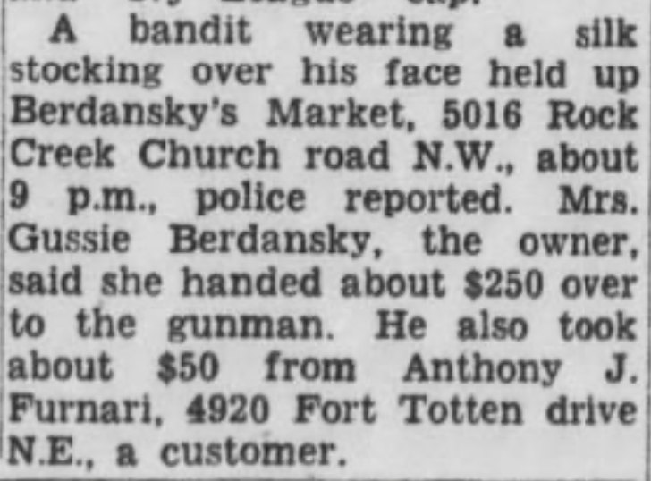
The store was called Leonard’s Market in the 1940s, then Berdansky’s Market in the 1950s. At that point the store was also part of the District Grocery Stores chain. DGS stores were primarily run by Jewish immigrants, who often spoke Yiddish while they learned the language. Problems with security were becoming more prominent, as you can see from the clipping in the Evening Star. Robberies continued to increase, and would remain a problem up to the present day. Around 1960 it became Cohen’s Market, Hyman and Helen Cohen proprietors.
At about that time the city decided to re-route Bates Road/Fort Totten Drive slightly to the east, eliminating the intersection of Rock Creek Church Road and Bates Road. However, an overhead view shows the original path:
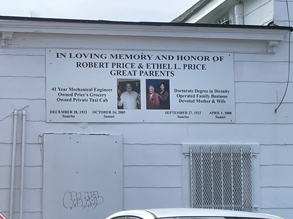
Hyman Cohen ran the store until the late 1960s, when numerous robberies and damage done during the 1968 riots convinced him to leave. Shortly afterward, it was acquired by Robert Price and his wife Ethel. Robert worked for Amtrak (previously Washington Terminal) and also drove a cab, Ethel operated the store. They were the first African American owners in the store’s long history. Robert’s son Clinton now owns the store.
Five years ago Clinton Price participated in an oral history program, along with a number of other Fort Totten residents. You can find their interviews at the DC Library DigDC site. In the interview, Price remembers when the store was still Cohen’s Market, how his parents decided to buy the store, and how he took over when his father retired.
If my research is correct, there has been a store on that spot for at least 160 years. More power to the Price family for keeping it going the past five decades.
The Wine House
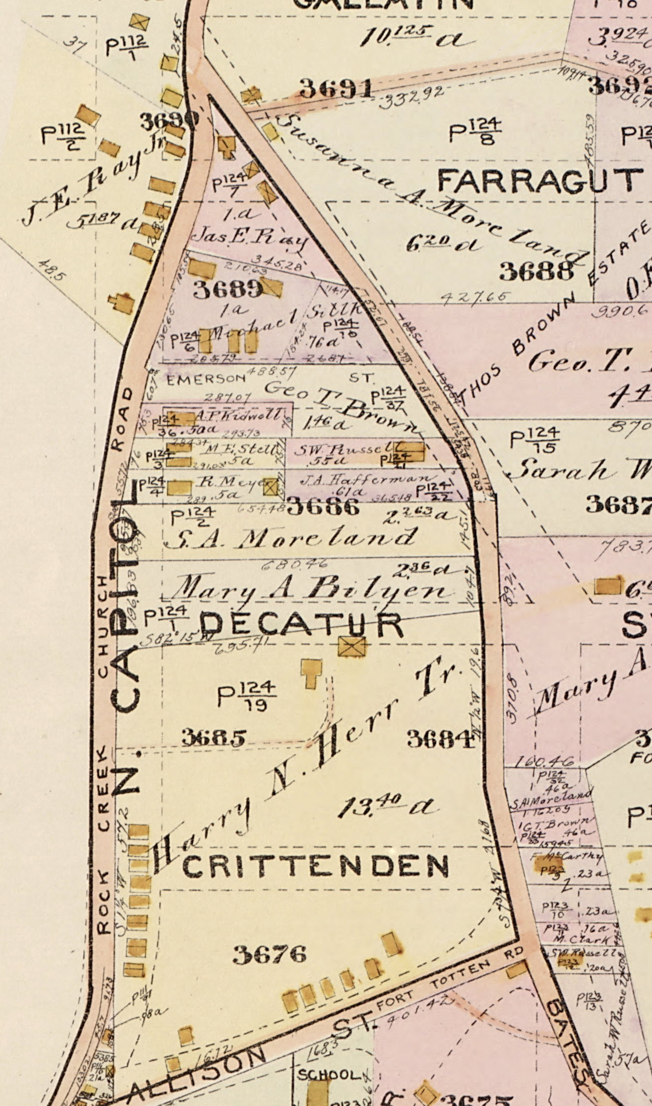
If you look at the 1887 Hopkins map again you’ll see just a few hundred yards south of Robert Barry’s store the 13.5 acre tract of John J. Rupli. In the 1880s John Albrecht leased the Rupli house and some of the land to grow grapes and open a restaurant in what became known as Rupliville. Here is a photo:
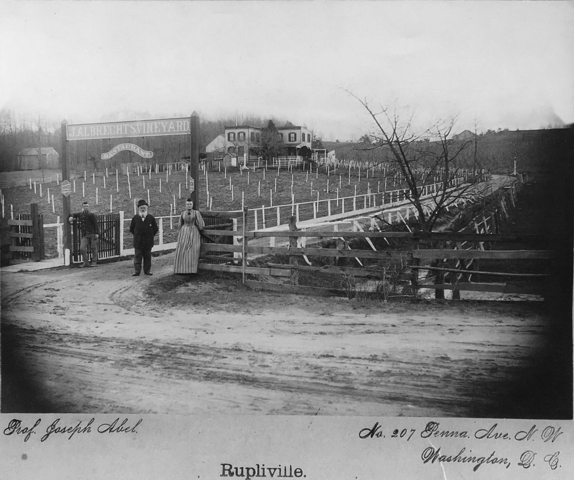
Wine Houses proliferated in Washington County, and Albrecht’s is a good example of one. Most of the proprietors believed they could sell wine made from their own vineyard without a license. That wasn’t necessarily the case, but police were hard put to patrol all the local wine houses.
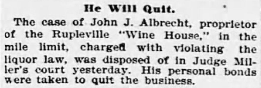
However, an 1895 law restricted wine houses within one mile of the Soldiers’ Home to sell only unfermented wine, i.e. grape juice. That brought an end to John Albrecht’s restaurant, as can be seen in the Evening Star clipping. That is Rock Creek Church Road at the bottom of the picture above, near today’s Crittenden Street. This section has been absorbed into North Capitol Street. At the very top of the hill on the right, the earthen walls of Fort Totten are visible.
By 1913, when the map on the right was made, Albrecht’s restaurant was long gone, but more and more houses were being built. In 1914, Evening Star columnist J. Harry Shannon, known as “The Rambler,” wrote about his walk along Rock Creek Church Road, starting at the Soldiers’ Home cemetery. He had some interesting, if racially tinged, observations about the settlement:
After reaching the end of the soldiers’ graveyard you come upon a line of dusty, shabby frame houses strung along the side of the road, their doors opening directly on the road. There is a blacksmith shop with the usual clutter of broken wagons and carts, which in most cases seem beyond mending…. Colored people mostly dwell in these poor, roadside houses, but the Rambler saw white faces at some doors and windows. He asked a native of the settlement, and, if he caught the answer correctly, the place is Ruppertsville…. Passing along, you come to houses, well kept and comfortable, though you suspect that the people living in them are not rich…. Soon you come to a store which stands at the intersection of three roads, the Rock Creek Church road, the Terra Cotta road and the Bates road…. At this house you turn southerly along the Bates road…. On the left is a wide stretch of woodland-chestnut trees, oaks and some pines. The soil is gravelly and footpaths criss cross through the woods. Following one of these to the top of the ridge you come upon long ditches, still deep and clearly defined…. This is the ruin of Fort Totten…. It is rather a lonely place, and you can get views to the east and north that are fine. You look out over the broad country through which Sligo branch and the Northwest branch flow, and to the eastward the vista takes in the blue and misty hills beyond the Eastern branch.
The fort today is much the same. Though the ditches may not be as deep and well-defined, it remains one of the better preserved earthen forts in the defenses of Washington. The Fort Totten neighborhood, however, is substantially different from its early days. Sometimes described as the last ungentrified neighborhood in Washington, it has grown significantly, especially around the Fort Totten Metro stop, which has seen a huge wave of development. The name Rupliville disappeared a long time ago, and the frame houses there were all replaced by tidy brick row homes from developer Morris Cafritz in 1939-1940. The area around Price’s Grocery is now filled with apartment buildings constructed in the 1950s and ’60s, and though the store may no longer be at a major intersection, it still manages to survive.
SOURCES:
This story was drawn primarily from newspapers and Washington DC city directories, the Evening Star being the most helpful, both for stories and real estate listings.
Nix-Gomez, Aaron, When vineyards were just miles from the U.S. Capitol: The wine houses of Washington, DC, 1880-1910. Hogshead, a wine blog. 2014
Voices of The D.C. Fort Totten Storytellers, DC Oral History Collaborative, DC Public Library, 2014-2024

Loved this! Thanks for the incredible research and narratives describing the roadways and communities. We used to play at Ft Totten as kids.
LikeLike
Fascinating as always, Bob! You are an amazing researcher!
LikeLike