When Brookland was first laid out in the late 19th century, the planners used some of the existing roads for the boundaries – Queens Chapel Road (now 18th St.) to the east, Brentwood Road to the south, the B&O railroad tracks to the west and Bunker Hill Road (parts of which are now Michigan Avenue) to the north. I’m going to take a look at each of those four thoroughfares, beginning with the oldest – Bunker Hill Road.
Before the initial construction of Washington (1790-1800), Georgetown and Bladensburg, Maryland were two of the most active towns in the area. Bladensburg, sitting right on the Anacostia River (then called the Eastern Branch of the Potomac) and at the intersection of many different roads, was a major commercial center and also became a tobacco inspection and grading port. Georgetown was an important tobacco town as well, so it isn’t surprising that a road was built joining them, probably in the mid-18th century. It didn’t seem to have an official name, called either the Bladensburg road or the Georgetown road, depending on the direction of travel. This map from 1794 shows it clearly:
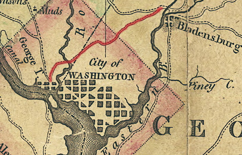
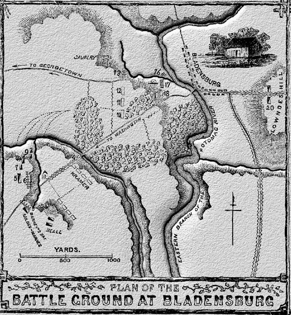
During the War of 1812, British forces raided up and down the Maryland coast and people feared that they would attack Washington or Baltimore. In 1814, they did, marching on Washington and meeting a motley group of poorly-trained American militia along with some veteran Marines at Bladensburg. The crack British troops fired Congreve rockets (like 4th of July bottle rockets, only bigger) and then crossed the river in force. The American militia broke and ran so quickly it became known as the “Bladensburg Races.” Some of the militia ran toward downtown along the Bladensburg Pike (today’s Bladensburg Road), but many ran along the Georgetown Road, hoping to regroup on the heights above Georgetown. They probably ran right through the area that would become Brookland, but the British didn’t chase them. Their troops instead rested a little while, then marched into downtown along the Bladensburg Pike and burned the Capitol (including the Library of Congress), the White House, and many other public buildings. Here’s a map of the Bladensburg battlefield, showing both roads:
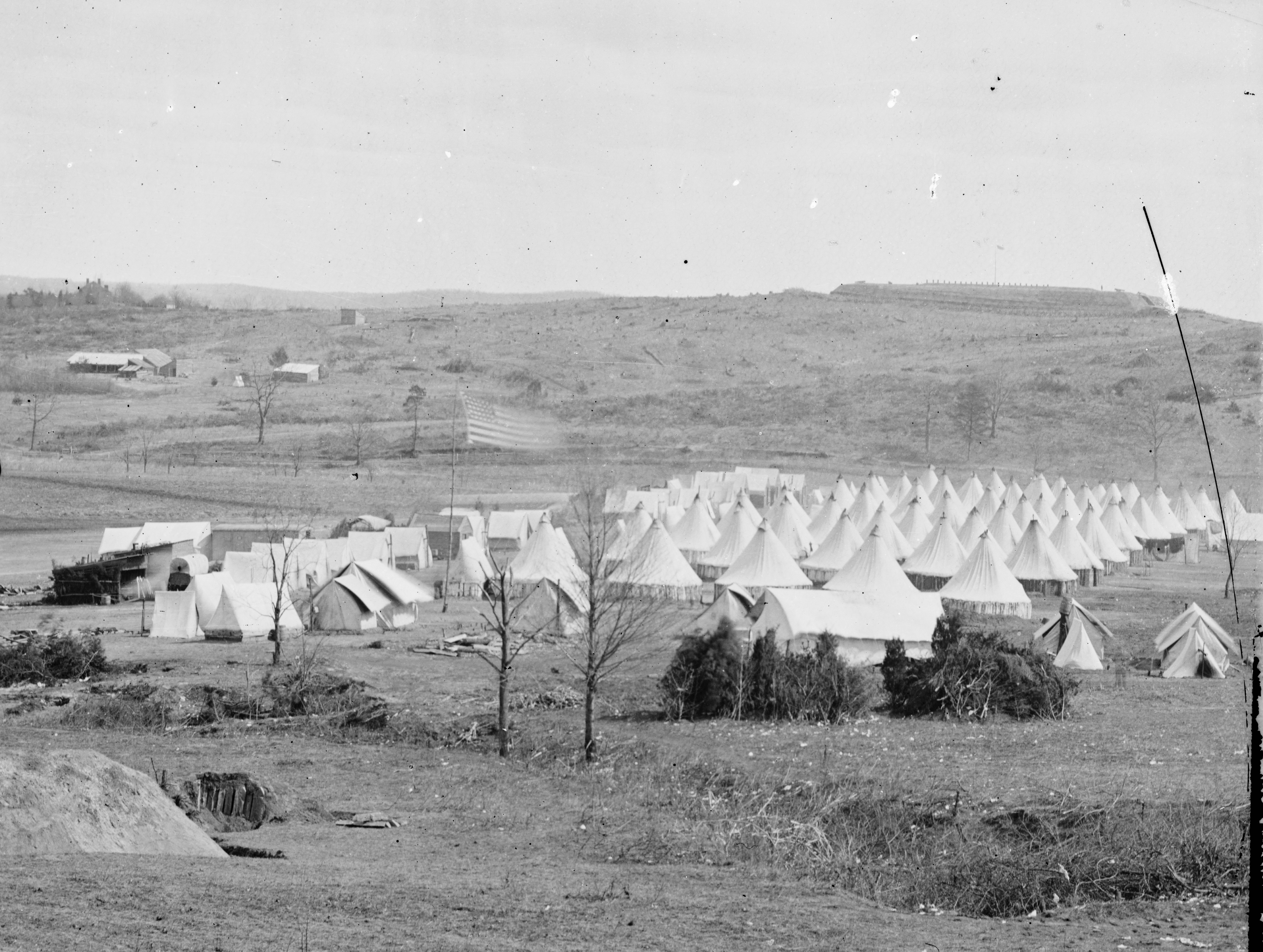
So how did our part of the Georgetown Road get the name Bunker Hill Road? That happened during the Civil War, when soldiers from the 11th Massachusetts Infantry built a fort on top of a small hill and named it after their state’s historic Revolutionary War battlefield – Bunker Hill. Here is the only known photograph of Fort Bunker Hill. The tents are where the Turkey Thicket playing field is now. The Georgetown Road is barely visible above the line of tents.
That road would soon became known as Bunker Hill Road. Around 1900, much of the Brookland part of Bunker Hill Road was absorbed into the new Michigan Avenue, though the original road still winds through Mt. Rainier, across Rhode Island Avenue and the railroad tracks, and through Cottage City, finally meeting the river at Bladensburg.
So the next time you drive along Michigan Avenue, remember that once horse-drawn wagons hauled tobacco along the same route, frightened American militia once retreated along it, and Civil War soldiers once used it to carry supplies to their fort. There’s a lot of history there.
