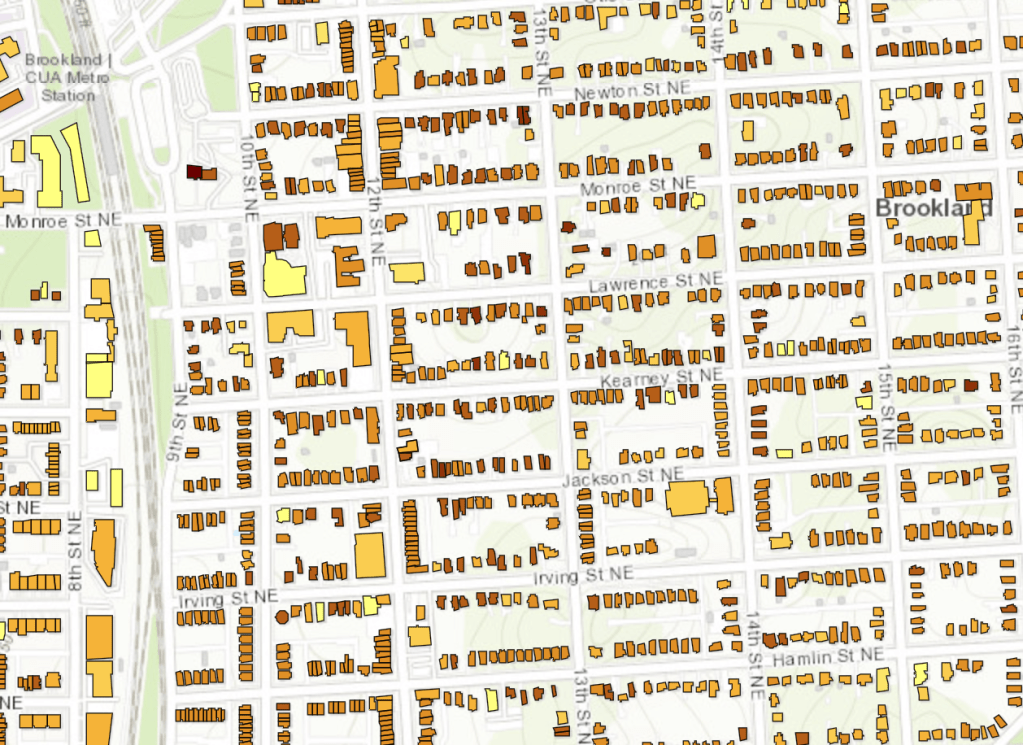
There’s a great new resource for people interested in house history in Washington. It’s an interactive map called History Quest from the DC Historic Preservation Office that shows a range of fabulous information for 127,000 houses in the District – dates of construction, architect, builder, original owner, materials used – though some of the older homes don’t have as much info. Click on the picture above to check it out.
The map certainly helps amateur local historians like me. I’ve been researching some of the oldest homes in our area, and the map makes that task much easier than digging through old paper and microfilm records at MLK library or the DC Archives. I’ve been looking particularly for still-extant houses built before Brookland was first subdivided in 1887. Back then it was all farmland, the homes were primarily farmhouse style, and only a handful remain. Below is an 1887 G. M. Hopkins map, showing the Brookland area just before subdivision. As you can see, there was no village, just farm tracts of various sizes dotted with a few houses. I’ve circled the location of the houses mentioned in this post.
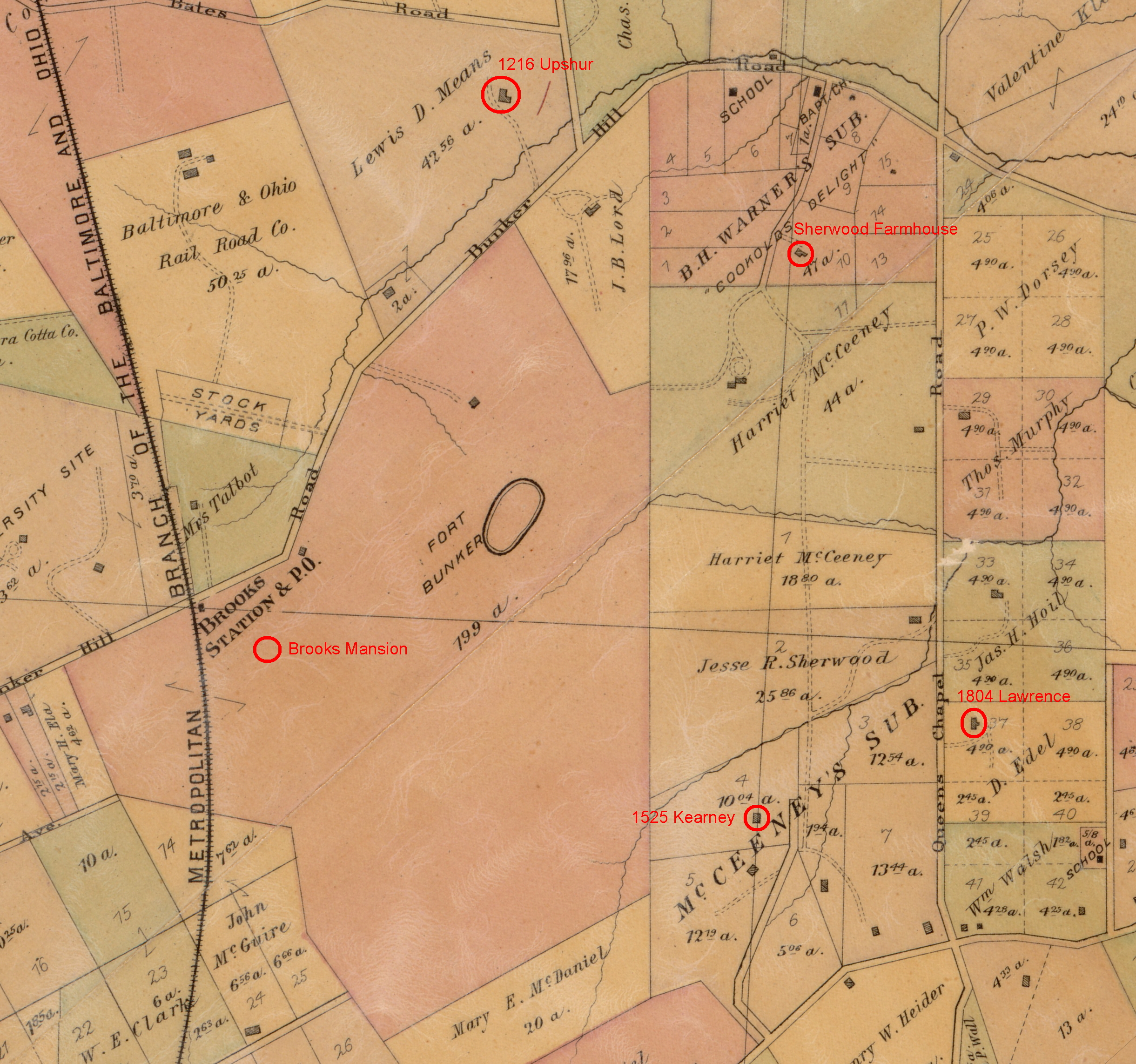
The oldest surviving home is, of course, Brooks Mansion, constructed between 1838 and 1840.

Called “Bellair” by Jehiel and Ann Brooks, only the western, square portion is original. The eastern wing was added in 1900 by the Marists. After Colonel Brooks’ death in 1886, the house was sold along with the property. Since then, it has been used as a boarding house, a college, a seminary, a women’s shelter, an elementary school, a high school, and today is home to DCTV.
James L. Sherwood built his farmhouse in 1886, just before Brookland was platted. It still stands on the grounds of the Howard School of Divinity at 1400 Shepherd Street NE, where it was used as office and storage space. It has deteriorated over the years, but it and the school building (originally Holy Name College) have been nominated for historic preservation.
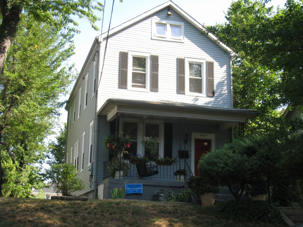
Another older home in the area, and one that is still occupied, is just east of 18th Street (formerly Queen’s Chapel Road) in Woodridge. The Robertson/Edel farmhouse still stands at 1804 Lawrence Street NE. It appears on the 1859 Boschke map of the region, when it was the home of Frederick Robertson and his wife Mathilda. Dietrich and Augusta Edel bought the place about 1873. Edel was a market gardener, growing produce on his farm and trucking it to the Northern Liberty and Center Markets downtown. When the land was subdivided after the turn of the century, the south side of the house jutted into Lawrence street, and in 1916 the developer moved it back 30 feet. Its orientation was also changed. The front of the house, which had been the western side facing Queen’s Chapel Road was switched to the southern side, facing Lawrence.
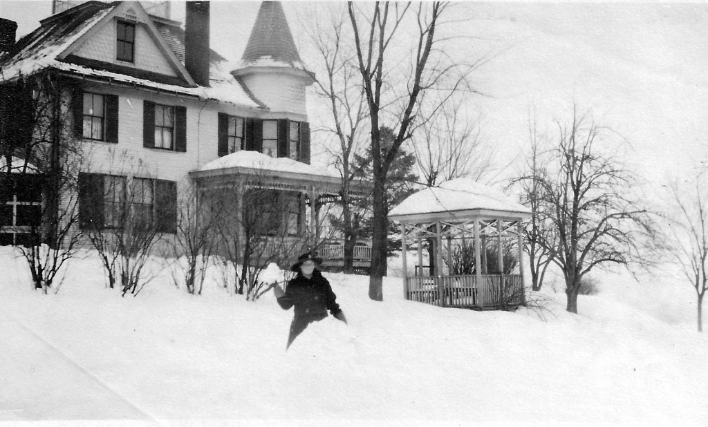
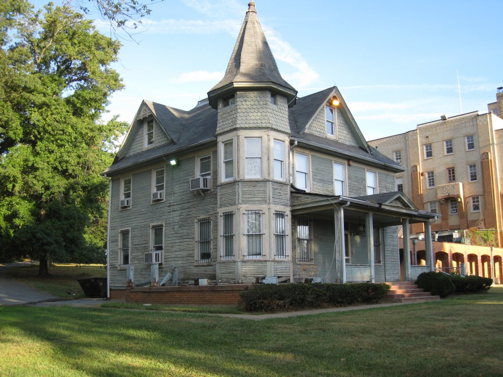
The oldest pre-subdivision home to survive seems to be the Tucker-Means house at 1216 Upshur Street NE in North Michigan Park. Kim Williams of the DC Historic Preservation Office has done a detailed study of the home in her paper Rural Remnants of Washington County. She concludes that Enoch Tucker bought 48 acres of land just north of Bunker Hill Road in 1854 and built his home there. After his death in 1869, the land and house passed to Gen. Orville Babcock, and then to Lewis Means. After Means’ death the land was bought by developers and streets were laid out. The old farmhouse jutted into Upshur Street, so it was slightly moved to align with the street grid.
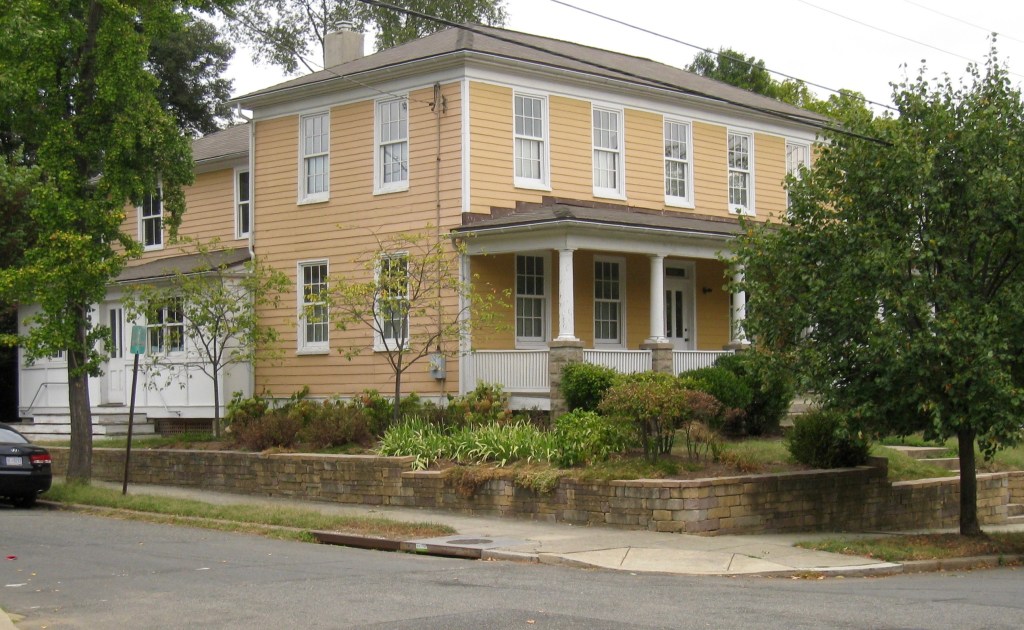
The house is currently owned by architect David Conrad. When we spoke recently he told me there was a serious fire there in 2001 and most of the interior was gutted, though he was able to salvage some doors, trim and mantelpieces. However, the damage did allow him to get a close look at the home’s structure and he saw it used drop-girt framing, a much older style of construction than today’s platform framing.

One more house that might be pre-subdivision is at 1525 Kearney Street NE. The History Quest map lists its construction date as 1887, and a building does appear there on the 1887 Hopkins map and all subsequent real estate maps. It is oriented very slightly askew from Kearney Street, which leads me to think the street grid was laid out after the house was already there. Nonetheless, the house is currently on the market and the real estate sites list its date of construction as 1910. It could be that part of the house is older, or that the original house was torn down and replaced in 1910. If anyone has any information about the true age of this home, please drop me a note.
Finally I’d like to offer my thanks to the folks at the Historic Preservation Office who did such a great job on the History Quest interactive map and made it freely available to the public. I applaud the public-spirited work they do.
———————–
Sources:
Kraft, Brian. “Woodridge: Failed Railroad Suburb Blossoms with the Streetcar” DCNorth, October 2003, p36-38.
Proctor, John Clagett. “Historic Spots Give Character to Brookland,” Sunday Star, Washington D.C., May 5, 1935.
Williams, Kim Prothro. “Rural Remnants of Washington County,” D.C. Historic Preservation Office, September 2013.
