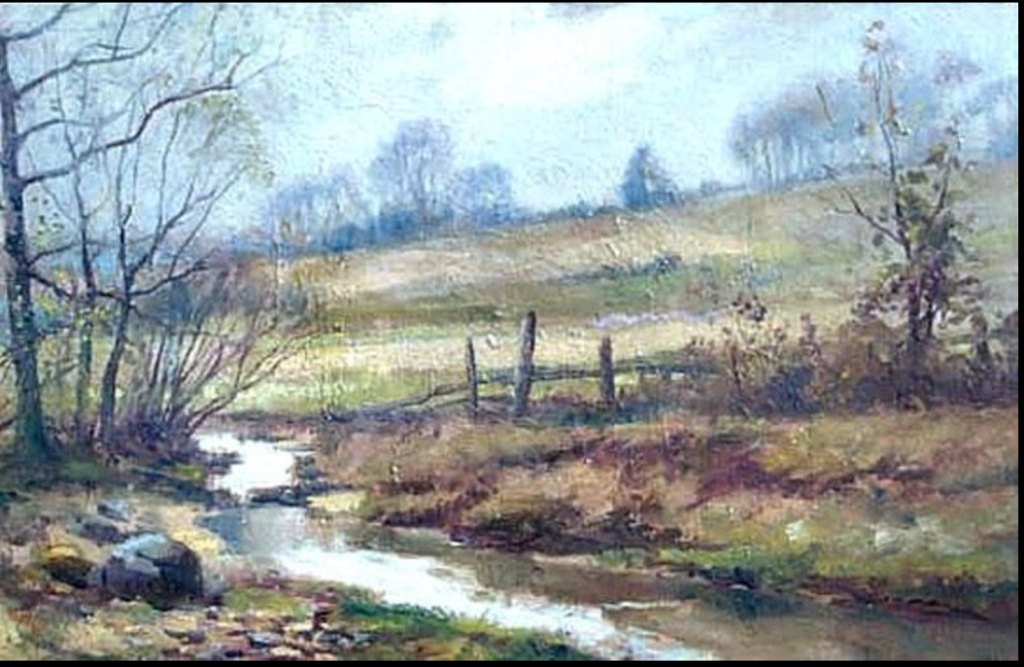
Well, not really a river, more like brooks and creeks, and they were liberally sprinkled throughout the Brookland region. The painting above, titled “Brookland, D.C.” by Edgar Hewitt Nye (1879 – 1943), gives a good impression of the bucolic nature of the land just as development was beginning back at the turn of the 20th century. As streets were laid out and houses built, the creeks were piped underground, until today there are none to be found freely flowing above ground in Brookland.
I wanted to see where the streams used to run, so I took a look at a number of maps from pre-development days. The 1861 Boschke map of Washington DC is the most detailed, quite accurate, and shows the creeks and rivers that ran through the whole District. Using a map tiling program, I overlaid the 1861 map with a contemporary one to see where those creeks once ran in the neighborhood. Here’s the result:
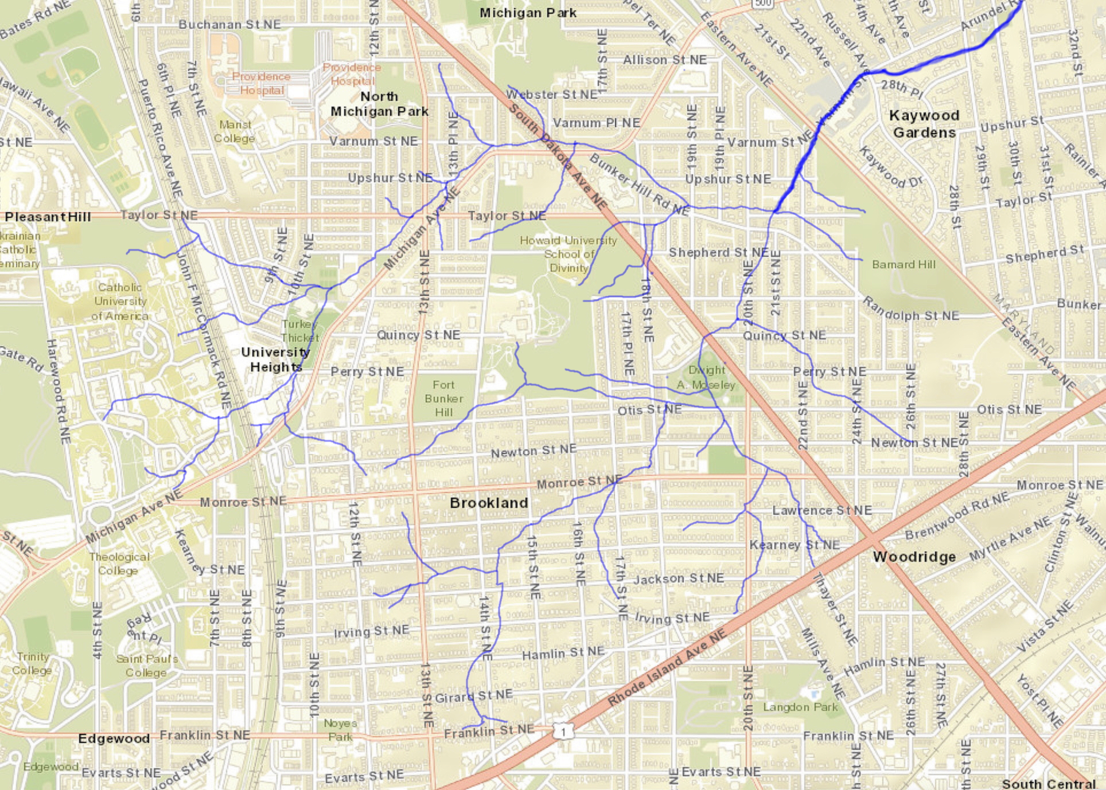
Of course, as streets were laid out and plots graded some of the configuration of the land was altered. Yet much remains essentially the same and there are many places where you can see how the streams once flowed. The valley between 13th and 14th from Newton to Otis was clearly once a creekbed; the odd-shaped vacant lot on the SW corner of 17th and Jackson is also delineated by a stream that ran through there. It’s hard to tell from the early maps which were major streams and which were little brooks you could hop over. The stream that parallels Michigan Avenue around the base of Bunker Hill seems to have been the largest.
Brookland is in the Anacostia watershed, part of the Northwest Branch sub-watershed. All of our creeks flowed generally northeast as tributaries of the Northwest Branch of the Anacostia River. As you can see from the map above, the two main streams converged at a point near today’s Taylor and 20th Streets NE, forming a larger stream that continued for another mile until it spilled into the Northwest Branch. Today it is all undergrounded until it emerges in the Kaywood neighborhood in Mt. Rainier and flows along a concrete lined channel (the Arundel Road Tributary) to the Northwest Branch.
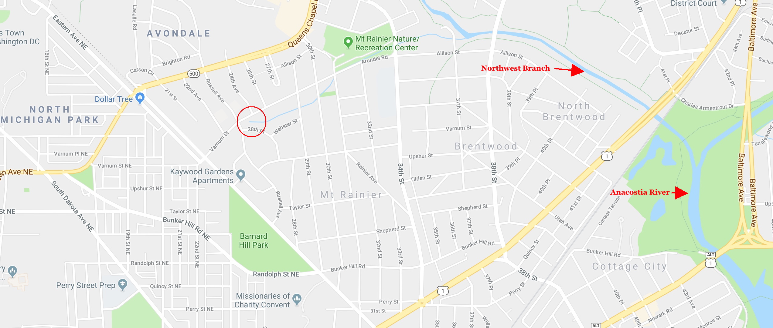

The concrete channel ends at 37th Street in Mount Rainier, and the final few hundred feet of the tributary are instead lined with rip rap (stone and concrete rubble), providing a more natural appearance. This is where Brookland’s waters end their journey, spilling into the Northwest Branch and then on to the Anacostia.

The Anacostia River is slowly coming back to life, thanks to concerned citizens, some government entities, and especially the Anacostia Watershed Society, who really spurred the river cleanup. John Kelly of the Washington Post wrote a lovely column recently about the revitalization of the river and the role of the Anacostia Watershed Society. Their mission: to have a swimmable and fishable river by 2025. Sounds like a noble goal to me.

One thought