This post was originally a talk/slideshow I gave for the George Washington University Museum. I thought it might work as a good primer for local history. Click to enlarge the images.
—————————-
This isn’t a strictly chronological or comprehensive history of Brookland. It’s more the story of the neighborhood as I’ve come to understand it over the fifty years I’ve lived here. I’ve highlighted some particular events and people I’ve come across in my research that I think illuminate that story.
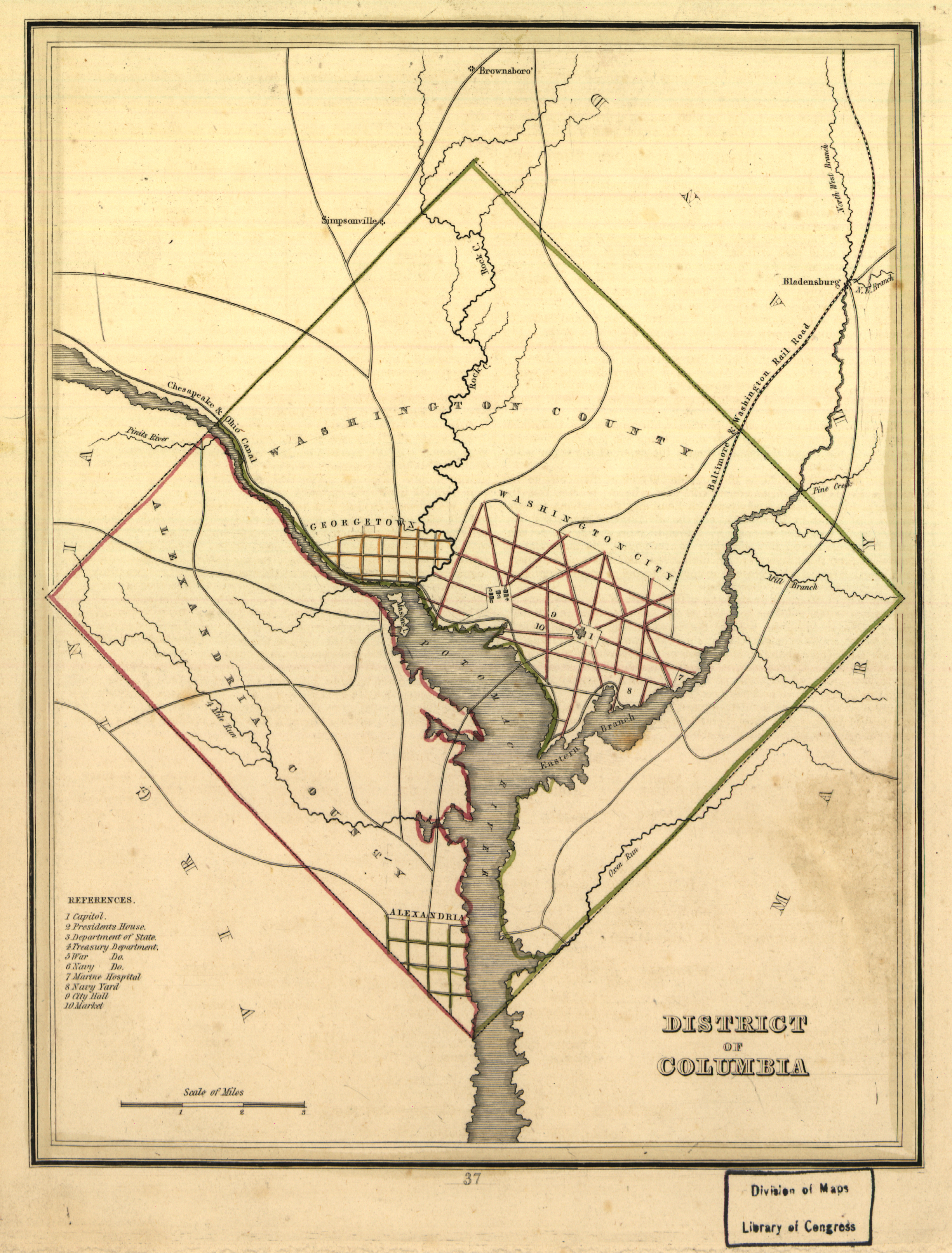
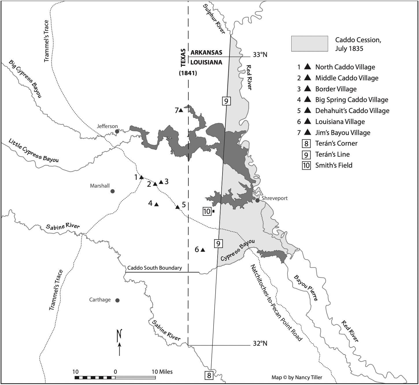
Brookland was first subdivided in 1887, but its real story starts further back. From 1801 to 1871, this area of the District of Columbia, north of Florida Avenue, and on the eastern side of the Potomac, was referred to as Washington County. It was separate from Washington City and Georgetown. This map from 1835 shows how it was laid out. Alexandria County was retroceded back to Virginia in 1846.
Washington County was mostly farmland, with a few estates of wealthy families. Slavery was legal in the District, and almost all the farms used enslaved workers to tend their fields and bring the produce to markets downtown. One of the larger farms in the area that would become Brookland belonged to Nicholas Queen, part of the extended Queen family that owned considerable land in the northeast part of DC.
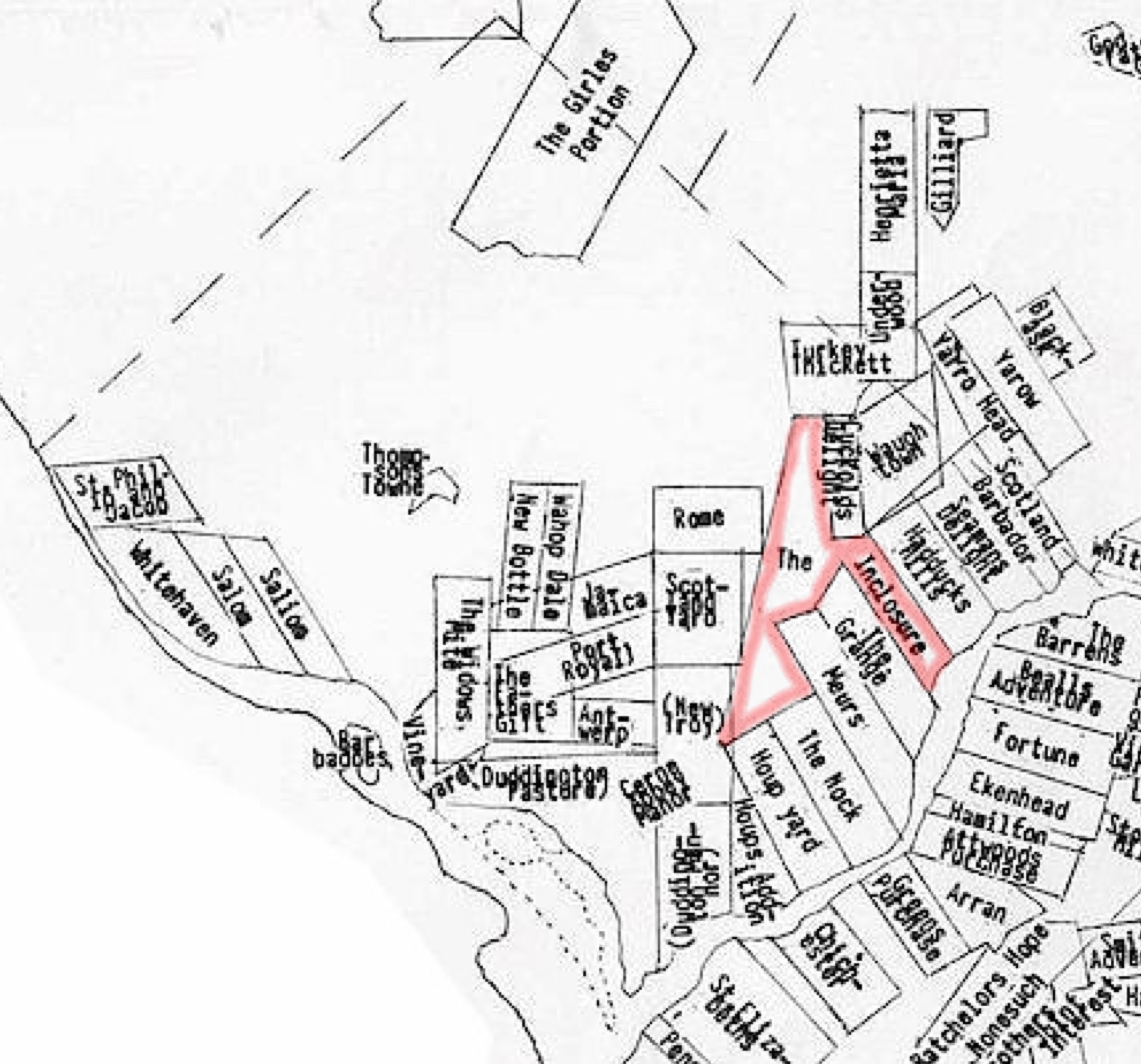
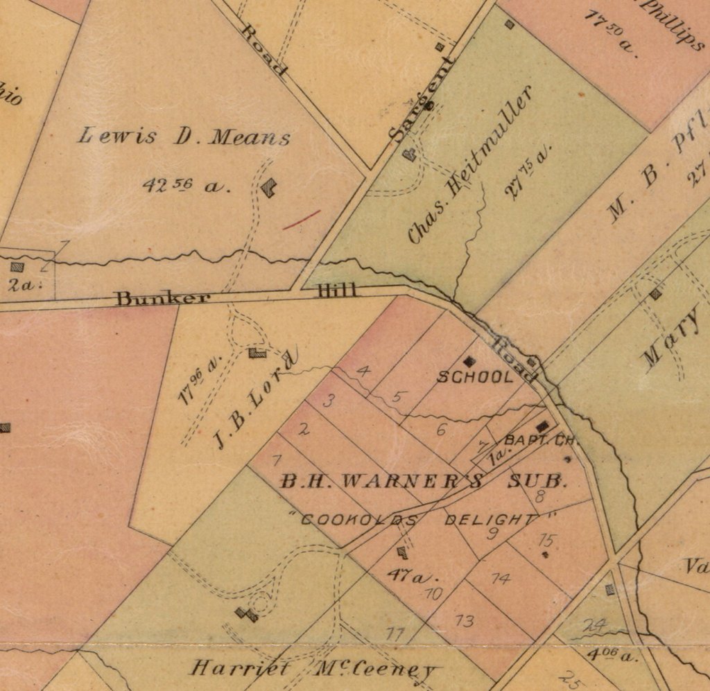
The original land patent was called “The Inclosure,” originally over 1,000 acres granted by Lord Baltimore to Ninian Beall in 1687. A pretty dull name, compared to some of the other patents – Widow’s Mite, Beall’s Adventure, Turkey Thicket, and my favorite, Cuckold’s Delight. Nonetheless, through marriage Nicholas Queen obtained a sizable portion of the Inclosure. At about that time, the late 1820s, Jehiel Brooks came to Washington.
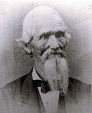
This is Jehiel (left) much later in life, obviously. Surprisingly, this is the only photo I’ve ever been able to find of him. If you used to visit Colonel Brooks Tavern on Monroe Street, I’m sure you remember this picture hanging over the bar. Born in Vermont and raised in Ohio, Brooks served in the US Army from 1818 to 1820 with a rank of 1st lieutenant, then went to law school and became an attorney, practicing first in Ohio and then in Louisiana. He came to Washington seeking an appointment to the vacant Red River Indian Agent post in Louisiana. Brooks asked numerous friends and acquaintances to write President Andrew Jackson, recommending him for the position. While here he met Nicholas Queen’s eldest daughter Ann. The two began courting.

In March of 1830, President Andrew Jackson awarded Brooks the Red River post. Two months later, Brooks married Ann Queen. Nicholas Queen then gifted over 200 acres of his farm to her, so technically the land that would become Brookland belonged to Ann, not Jehiel Brooks.
They moved to Louisiana, where Brooks spent five years getting to know the Native Americans of the Caddo Nation and tending to their affairs. He also started raising a family, fathering two children during his tenure. He then began negotiations with the Caddo to sell their lands in the northwest corner of the state to the US and leave the area.
In 1835 Brooks returned to DC with a treaty in hand, but also with a lawsuit for fraud due to some questionable land deals associated with the treaty.
While contesting the litigation, which would go on for over a decade, Brooks built a fine Greek Revival home he called Bellair and we call simply Brooks Mansion. It still stands and is now the home of DCTV.

The original mansion was only the part seen here. The eastern wing was added by the Marist Brothers in the 1890s.
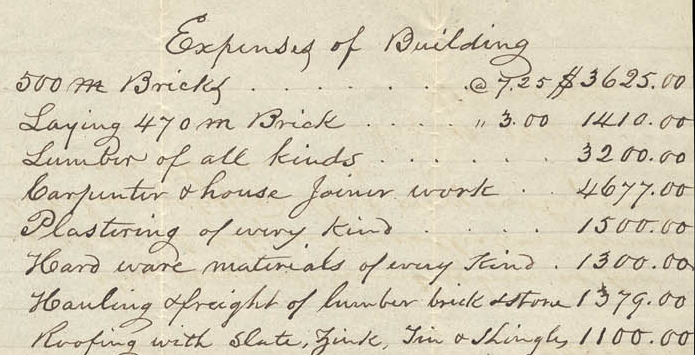
Bellair cost $25,000 to build, around $800,000 in today’s money. With his father-in-law’s farm adjacent to his, Brooks took on the role of gentleman farmer, though his interests didn’t really lie with farming. He gravitated to horticulture, spending considerable time and money on landscaping the grounds around the mansion.
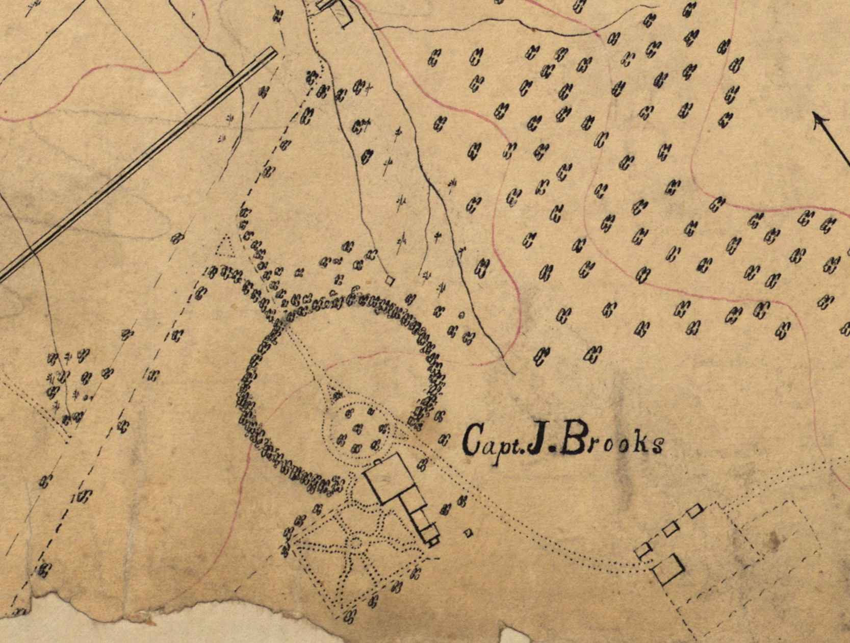
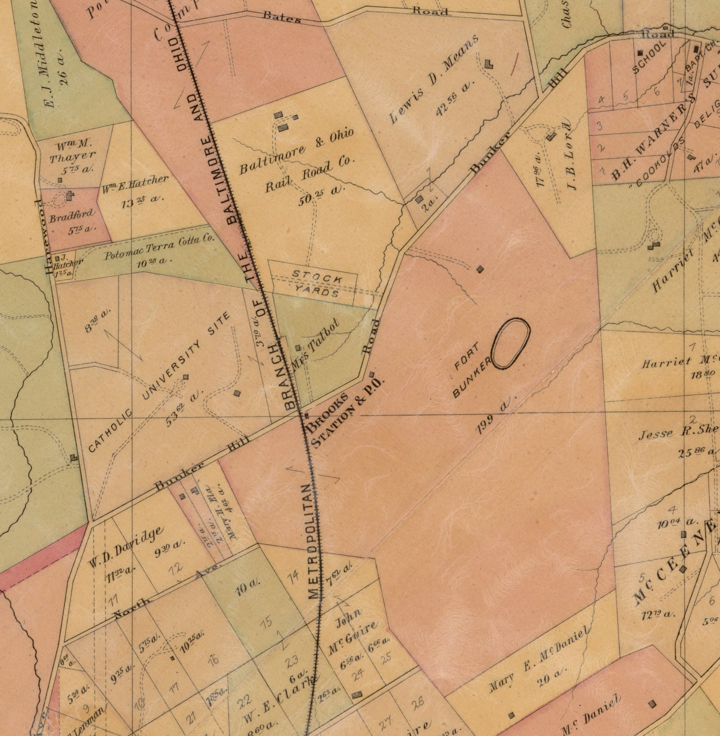
This remarkably detailed map from 1863 shows a long driveway that comes off Bunker Hill Road through a lane of trees that opens into a circular front yard. Next to the mansion and its outbuildings is a walled formal garden. Inside the wall is a greenhouse, a well, flower and vegetable plantings, and plum, cherry, apricot, nectarine, and fig trees. Visitors were quite impressed.
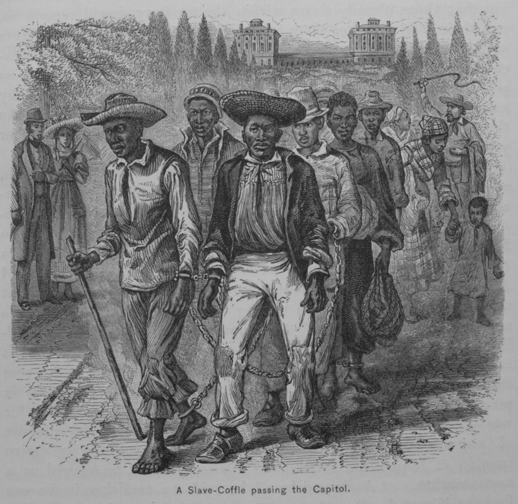
Queen, Brooks, and almost all the other farm families in the area used enslaved people to tend their fields and homes. Still legal in the District and Maryland at the outbreak of the Civil War, slavery was an established part of the local economy.
When Union soldiers came pouring into the District in 1861 and camped on many of the farms in Washington County, there was obvious friction with the residents. The soldiers viewed them as slave-holding rebels, while many of the farmers saw the military as occupational forces.
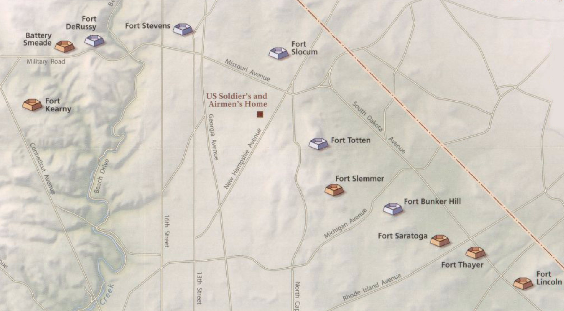
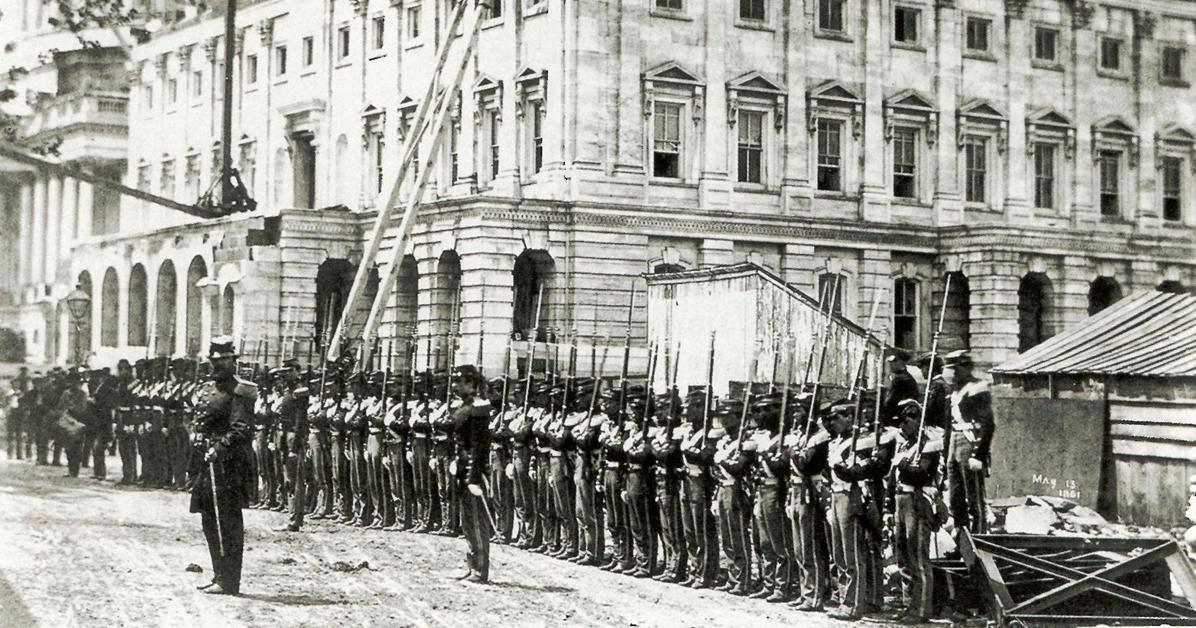
That was especially evident when the Army engineers began building a ring of forts around the city in 1861. The Army took whatever land they deemed necessary for defense, no matter how it impacted the farms.
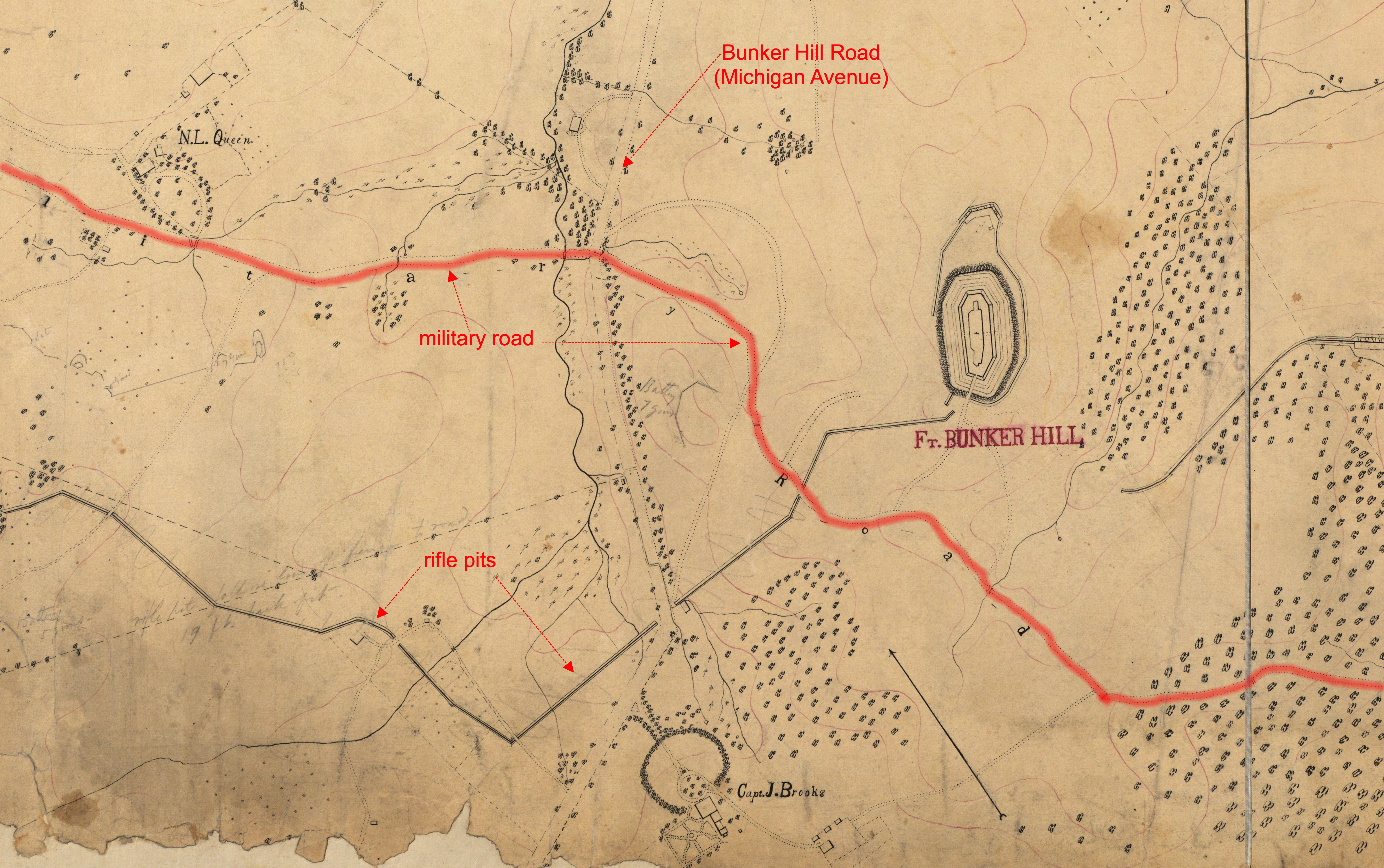
Both the Queen and Brooks farms were substantially affected by the construction of Fort Bunker Hill and the troops that camped on their property. Trees were clearcut, rifle pits dug, and a military road laid out through the fields to connect all the forts.
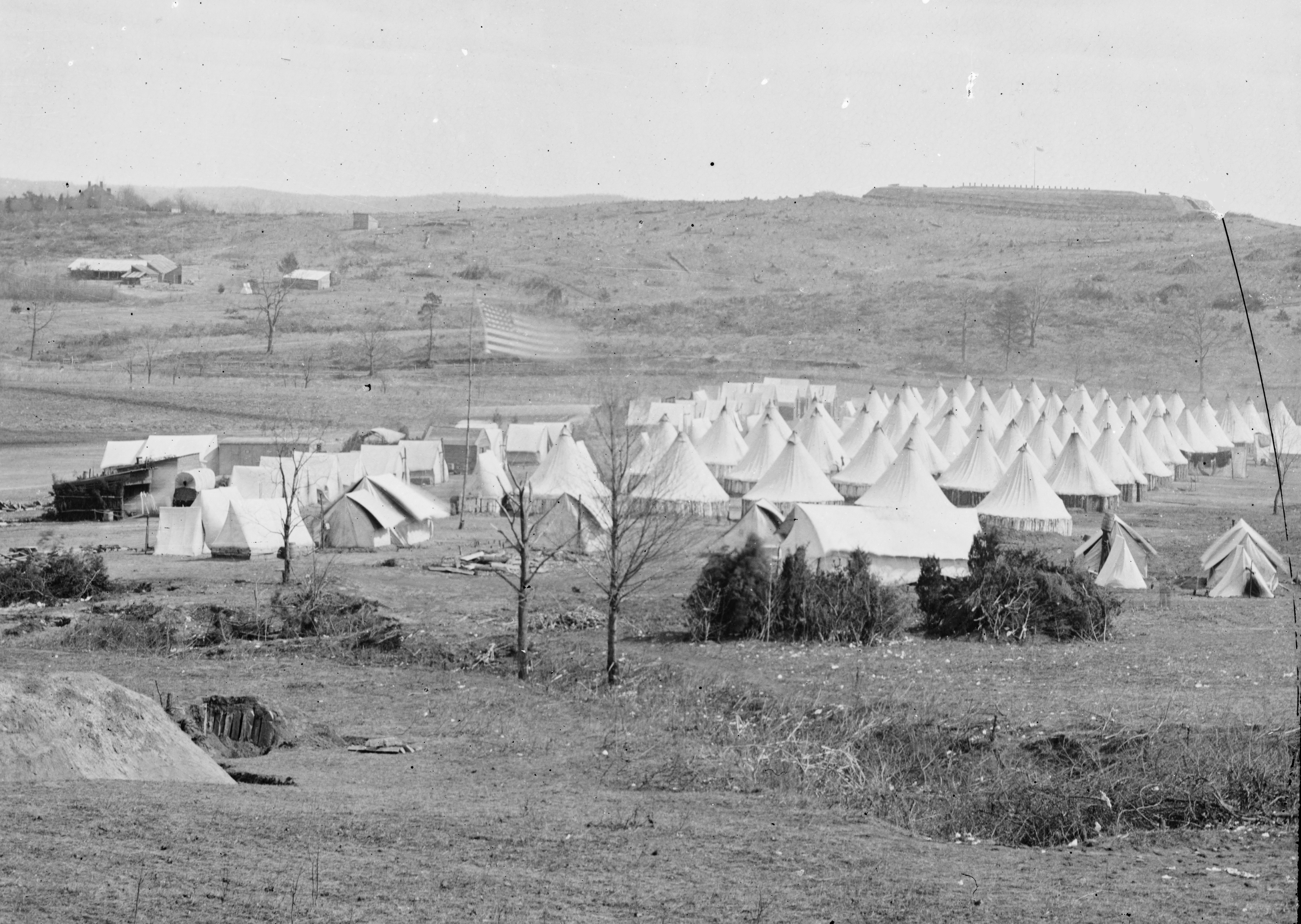
This photograph from the fall of 1861 shows the tents of the 82nd Pennsylvania on Queen’s farm, with the newly-constructed Fort Bunker Hill atop the rise. You may wonder why it was called Fort Bunker Hill; why do we have Bunker Hill Road in Brookland? It was the 11th Massachusetts Infantry who built the fort and named it after their state’s famous Revolutionary War site. I don’t think the hill had a name beforehand. This camp was a kind of way station for troops about to head into the field of battle. Some of the soldiers were even able to bring their families to the camp.
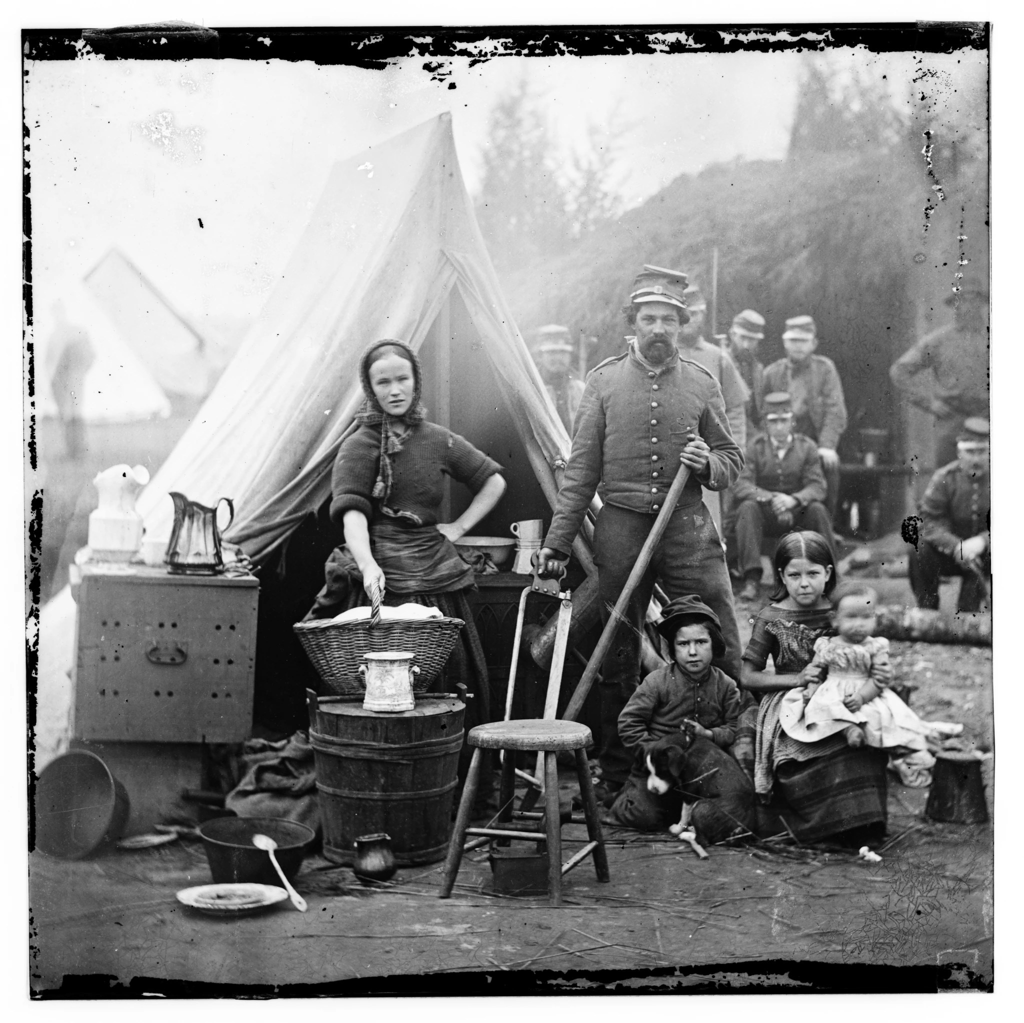
Wives were sometimes employed at the camps as cooks or laundresses. This famous photo was taken the same day as the previous one, on what is today Turkey Thicket ball field.
We don’t have a closeup of Fort Bunker Hill, but we do have one of Fort Slemmer, built nearby on what is now Catholic University property.
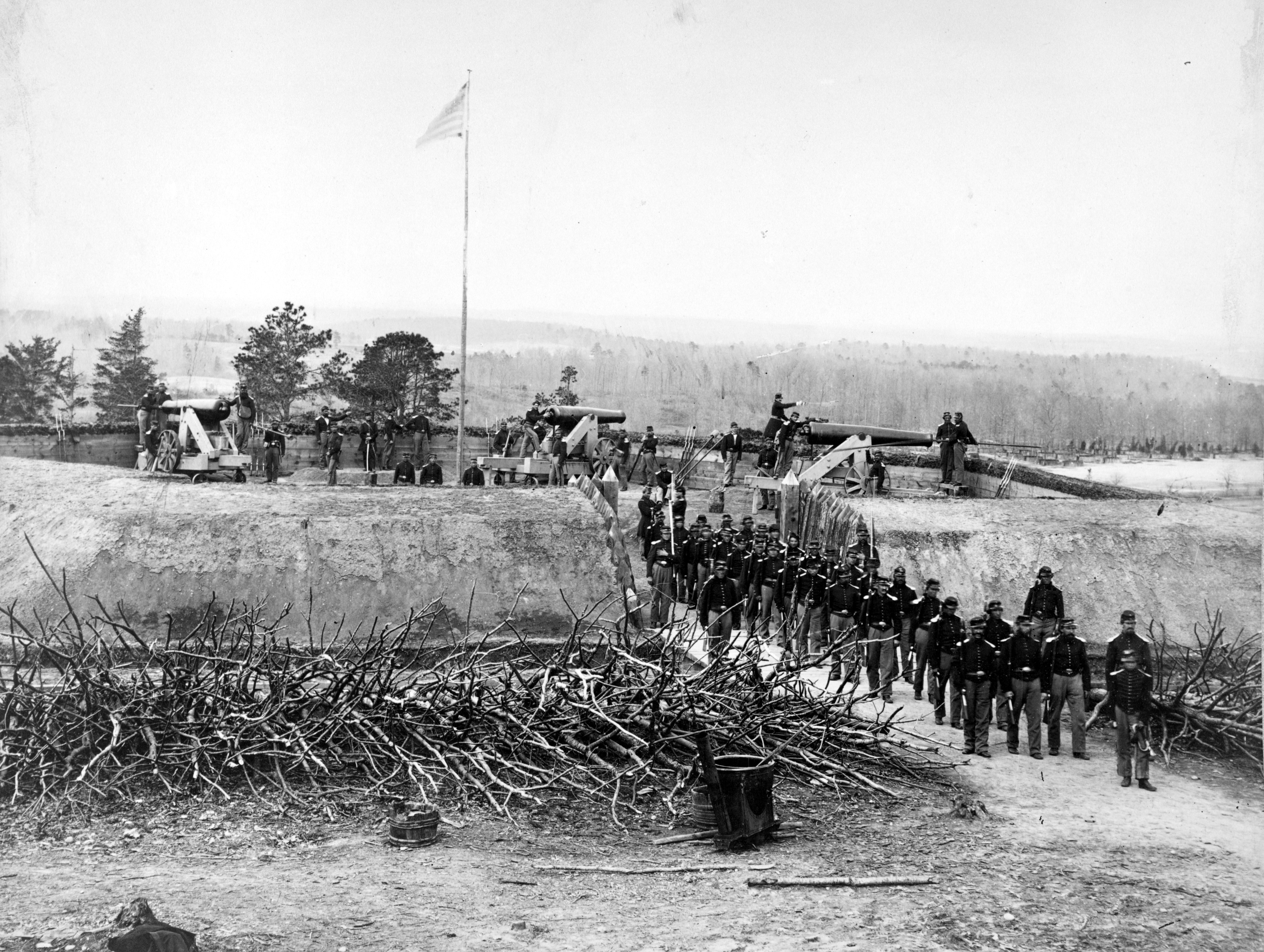
This photo shows in detail the construction of these forts. The earthen walls are well defined but would need constant maintenance. Wooden planks support the inner wall. The abatis, sharpened tree branches, would be intimidating for any enemy to try to breach. Building these forts took a lot of manpower, and it’s likely that the Queens and Brooks hired out some of their enslaved workers to help build the fort and camp, but that wouldn’t last long.
In April of 1862, President Lincoln signed the Compensated Emancipation Act which freed all those held in bondage in the city, while compensating the owners for their financial loss. The owners had to fill out petitions, listing in detail the people they had enslaved, including their full names, a rarity in American records.
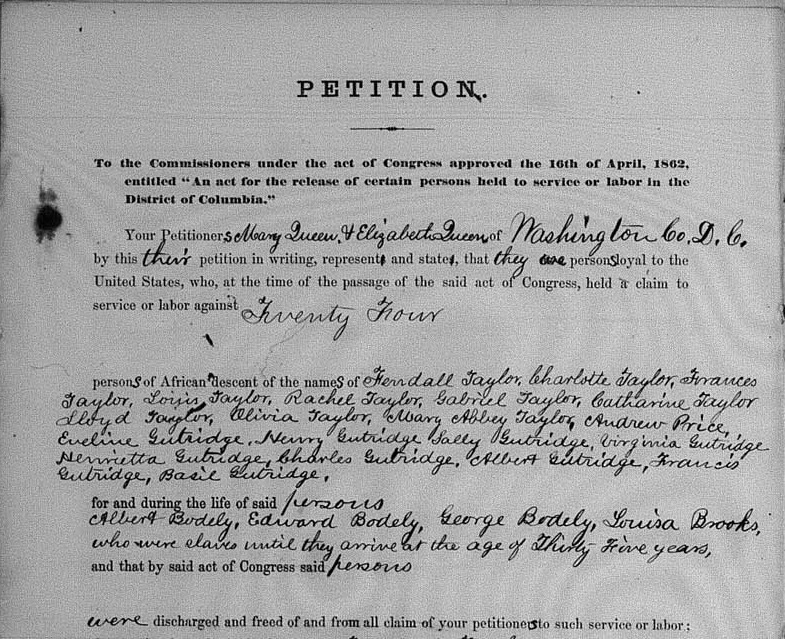
The Queen and Brooks farms had enslaved 24 people. They asked for $19,000 in compensation (about a half million in today’s dollars), but the government’s calculation was much lower, awarding them $8,256.30. The freed people quickly left the farms and either looked for work downtown, left the city and headed north, or joined the Army when they were allowed in 1863.
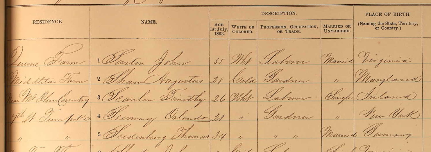
In the Army register above you can see on the top line one of the White workers on Queen’s Farm had signed up, and just below him, a formerly enslaved man on the Middleton farm also signed.
After the war, the Queen and Brooks farms limped along for a few years, though the damage the Queen farm sustained was substantial. Nicholas Queen had died in 1860, and his son Henry died just 10 years later, leaving the land in the hands of Henry’s sisters, Elizabeth and Mary Queen. They decided to sell part of the land to the B&O railroad, who built a stock yard on the property. In 1873 the B&O opened the Metropolitan Branch that ran from DC to Point of Rocks, Maryland, where it joined the B&O main stem.

That railroad was a major spur to development. Gaithersburg, Rockville, Kensington, Silver Spring, all grew substantially thanks to the Metropolitan Branch.
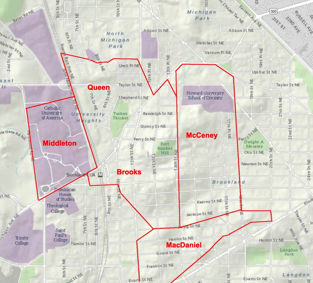
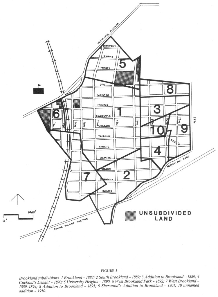
Jehiel Brooks wasn’t happy about the railroad, since it cut right across his fields, but there wasn’t much he could do to stop it. At least they put a station at his farm. All of Washington County was changing now. DC’s population increased by leaps and bounds during the Civil War and continued to grow afterward. Many of the farms and estates north of Florida Avenue were now being bought by developers, divided into lots and sold as new subdivisions. Here is a map of the farms in the area, all of which would be sold in the 1880s and ‘90s.
The Middleton farm, on the left, was sold in 1885, not as a subdivision, but to be the home of the new Catholic University of America. A year later, Jehiel Brooks died and his property was sold and developed as the first subdivision of Brookland. Eventually there would be ten subdivisions, the last added in 1910.
Brookland and Catholic University grew up together, and each would influence the other over the years. But the first actual church in Brookland wasn’t Catholic.
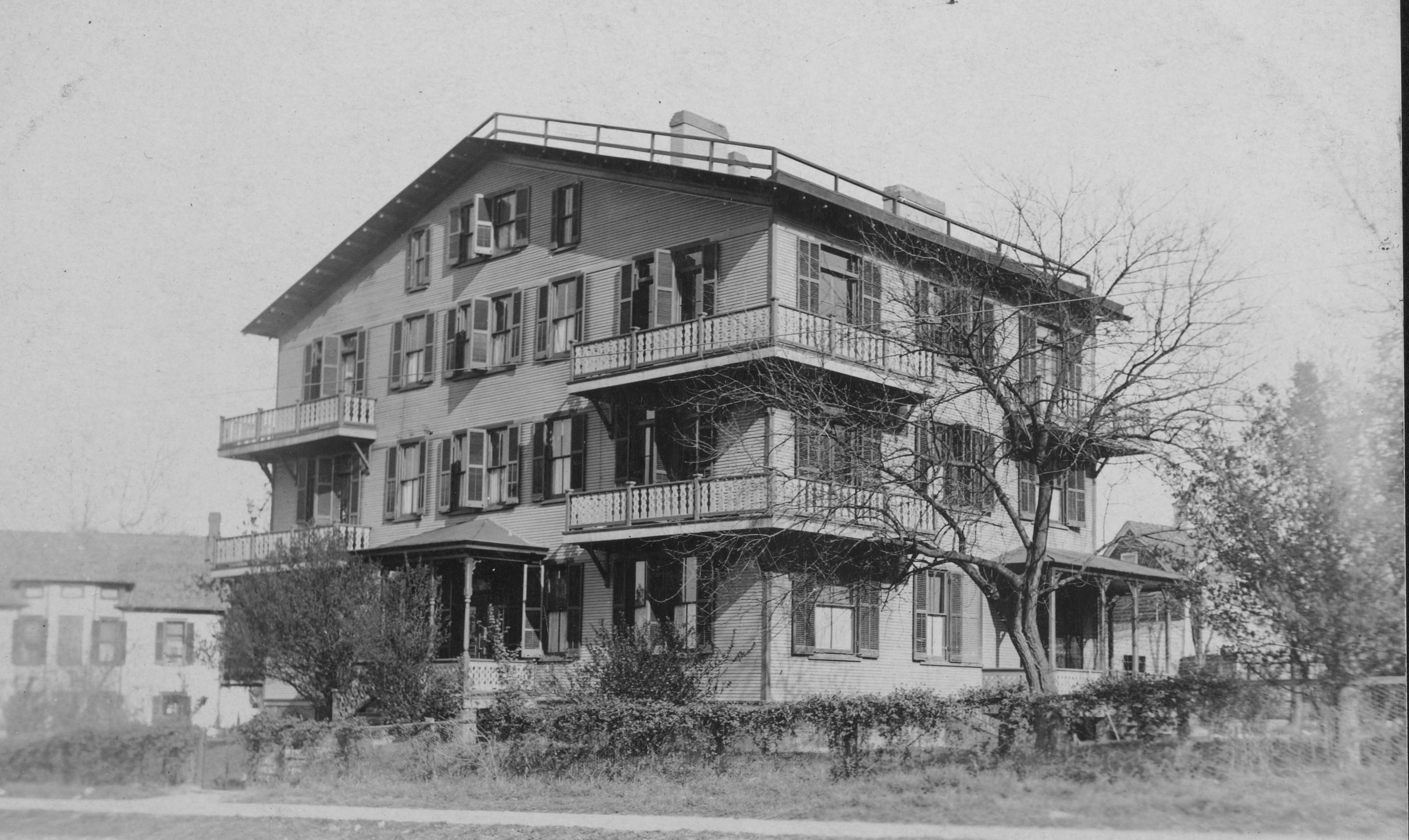
The Queenstown Baptist Church had been founded in 1881, before Brookland was subdivided. You can see it on the right of this 1887 map. Once development began the congregation grew quickly and they built a new church on the corner of 12th and what is today Newton Street and changed their name to Brookland Baptist. Here it is in 1891:
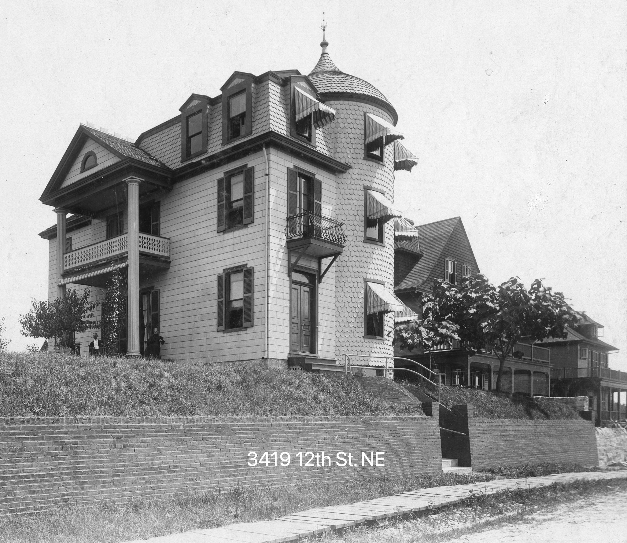
This photo also gives you a good idea of just how open and rural this area was during its earliest years. The streets are still unpaved, the sidewalk is wooden, waterlines and sewers still being installed. But the lots were big and the prices moderate, so the neighborhood grew at a steady pace. People built houses that were sizable, but not ostentatious for the most part, and in a variety of architectural styles. Here are a few early ones, along with some of the people who built them:
Antoinette Margot worked closely with Clara Barton, founder of the Red Cross in America, for a number of years. She became an ardent convert to Catholicism, moved to Brookland in 1889 and built this home which she called Theodoron, “God’s Gift.”
The home sat on what we now call the Brookland Green, facing Bunker Hill Road. Margot reserved one room as a classroom, where she taught art. She reserved another room as a Catholic chapel, and worked with a Catholic U professor, Henri Hyvernat, to get permission to hold mass there.
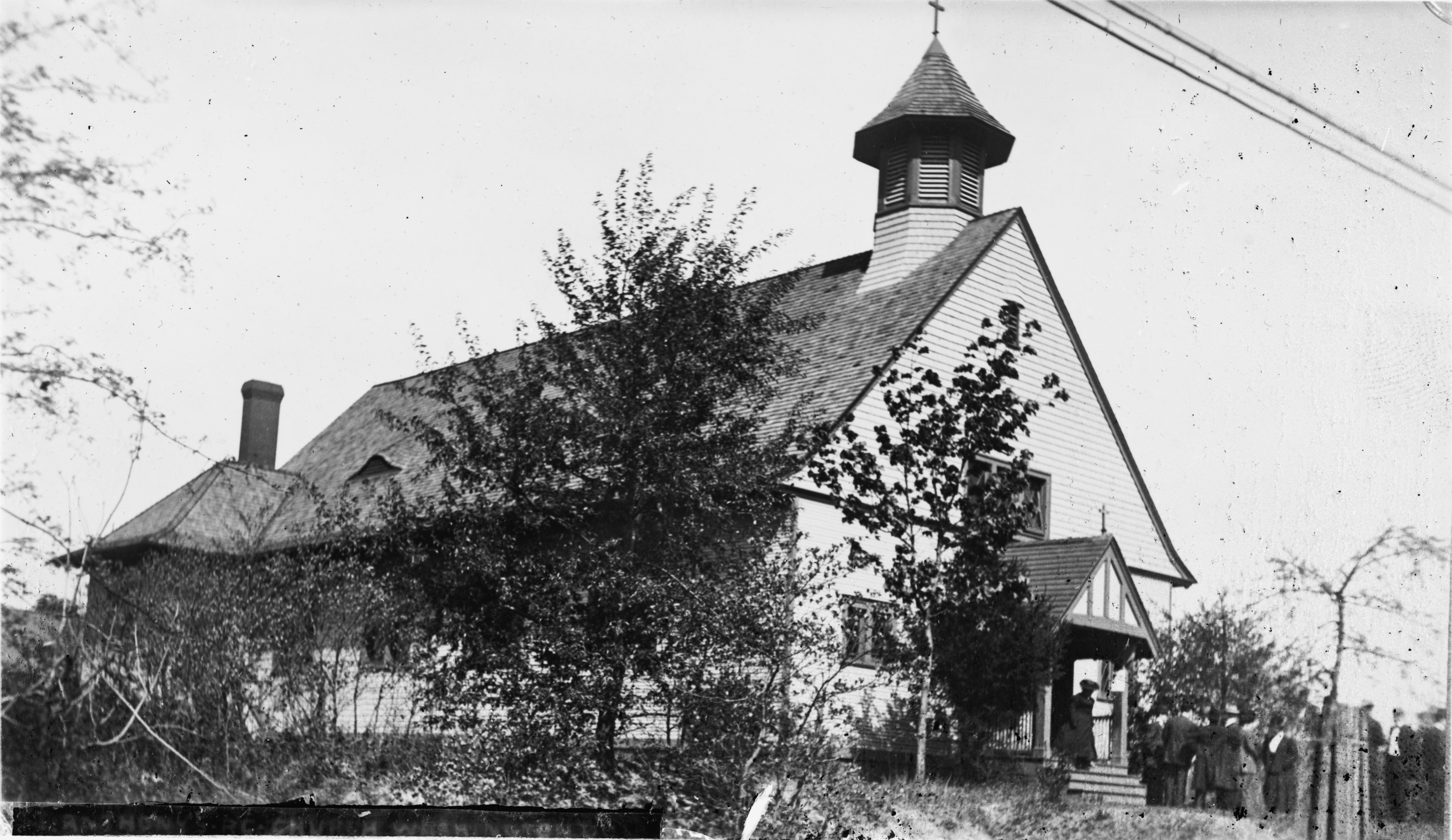
Over the next few years the two worked together raising funds for a new church. They bought property at the corner of 12th and Monroe Streets and in 1896, St. Anthony of Padua Catholic Church was dedicated.
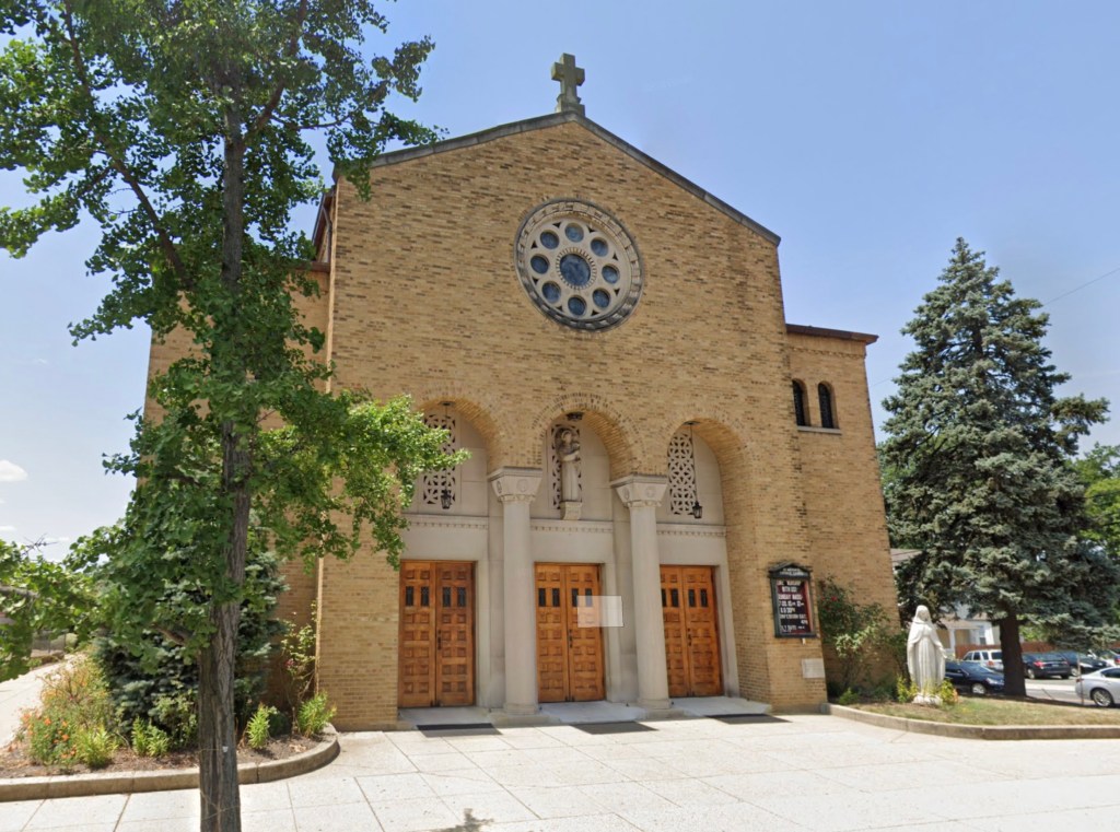
The wood-framed church was replaced by this Romanesque brick one in 1938.
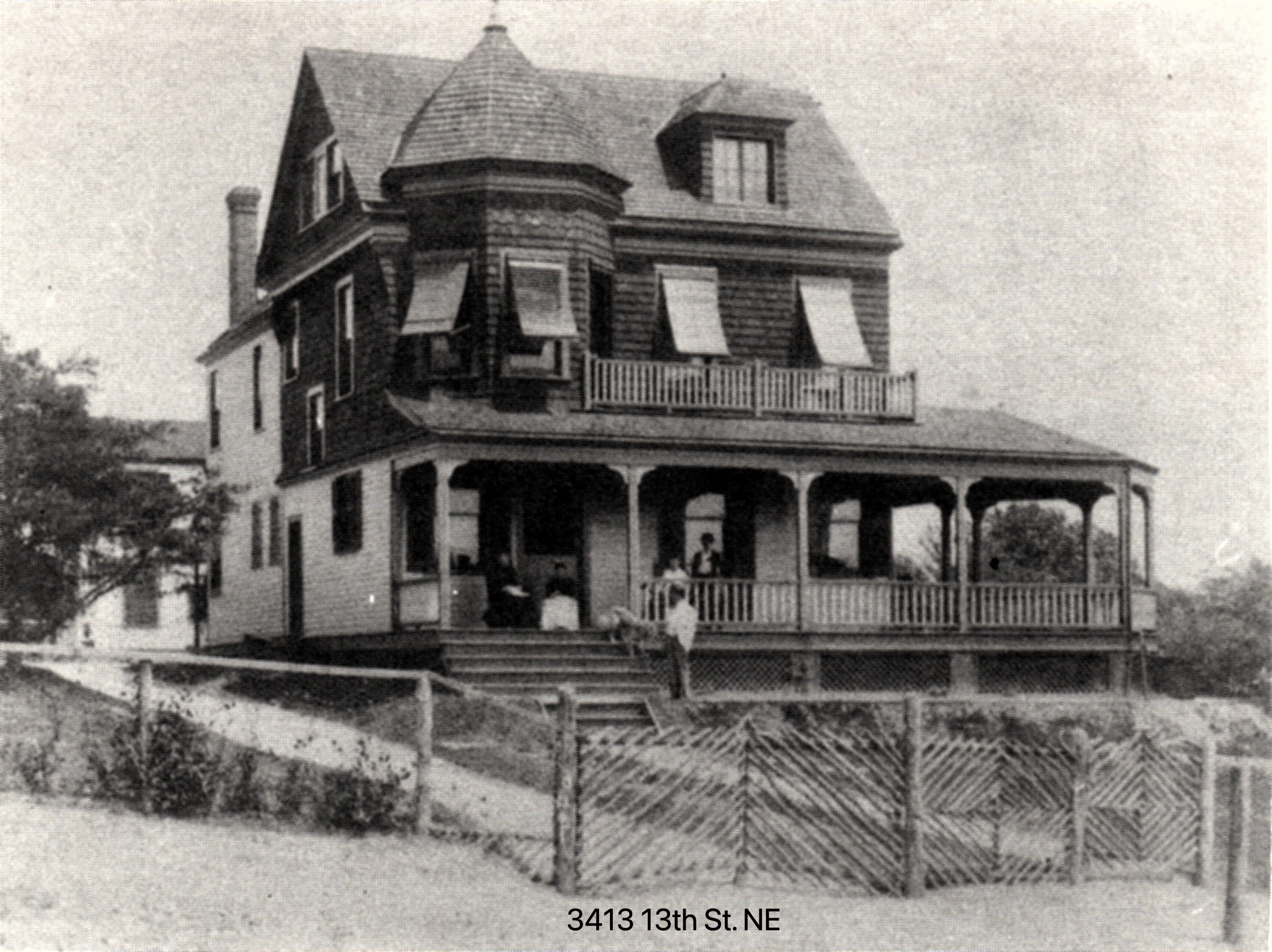
Across the street from St. Anthony’s, Charles McCarthy, a professor at Catholic University, built this intriguing home. Brookland houses displayed a wide range of architectural styles over the years: farmhouse, Queen Anne, craftsman, and some singular ones as well.
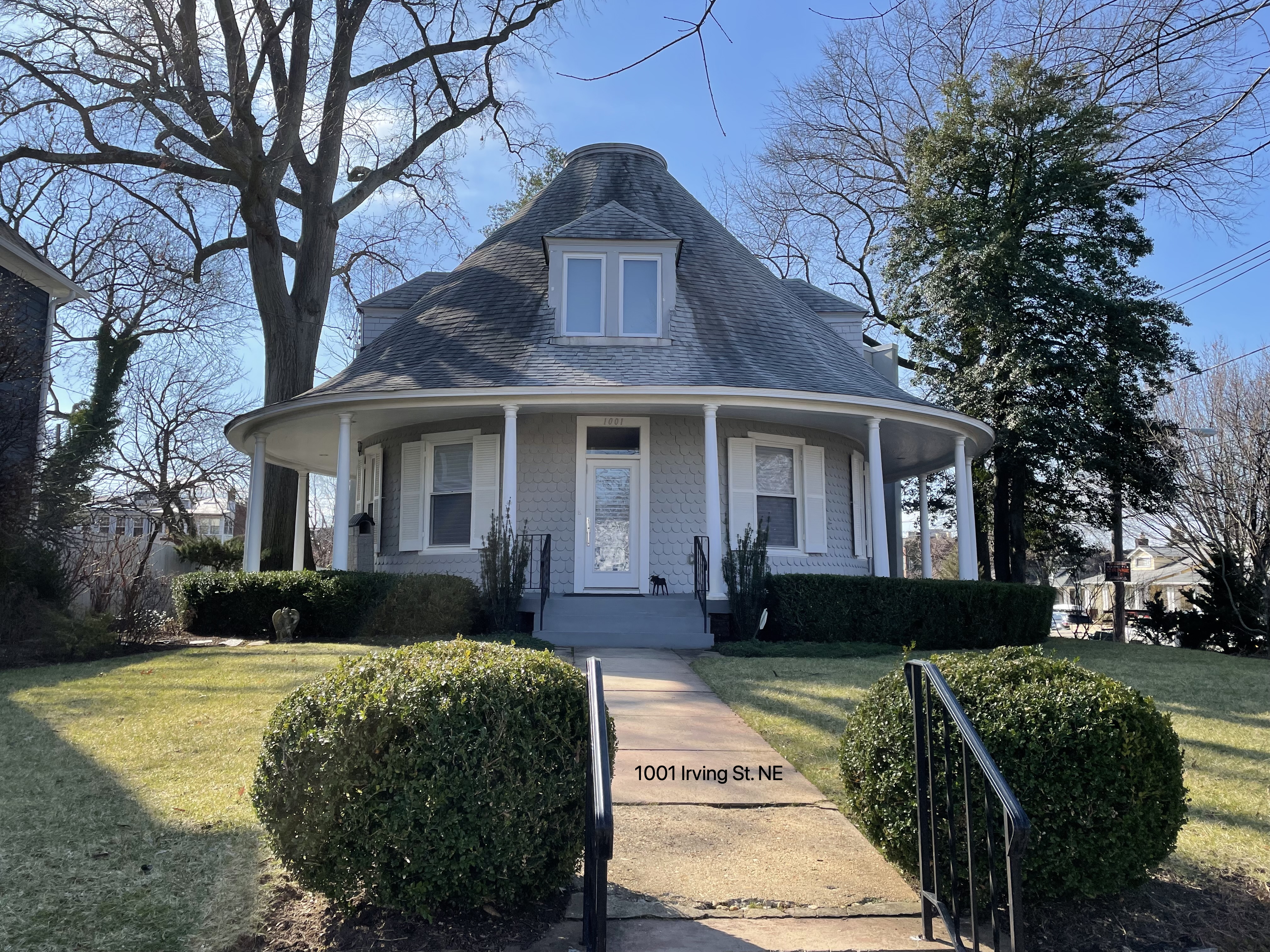
The Round House at 10th & Irving was built for John C. Louthan in 1901. Apparently he built it so his wife, who used a wheelchair, could more easily get around. It still stands, with an appropriately curved addition to the back.
Another lovely home was that of Robert Ridgway, celebrated ornithologist and Curator of Birds at the Smithsonian.
He called it “Rose Terrace.” An avid horticultural layman, Ridgway spent considerable time planting, weeding, and trimming the grounds of the natural oasis he created at 13th & Lawrence.
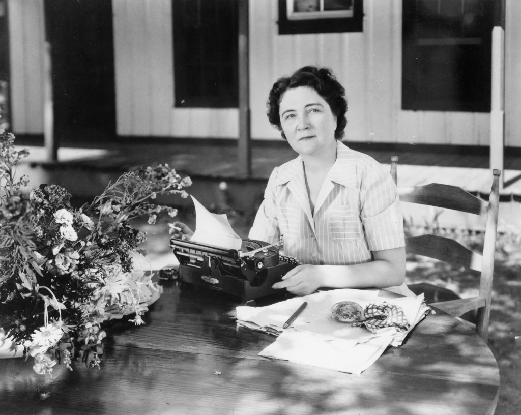
Below is the home of Arthur Kinnan, built on Newton Street in 1891. He became a powerful force in the development of Brookland as President of the Citizens Association. But more lasting fame came to his daughter, Marjorie.
Born and raised in Brookland, she later moved to rural Florida and became an acclaimed author as Marjorie Kinnan Rawlings. She won the Pulitzer Prize for Fiction in 1939 for her novel “The Yearling.”
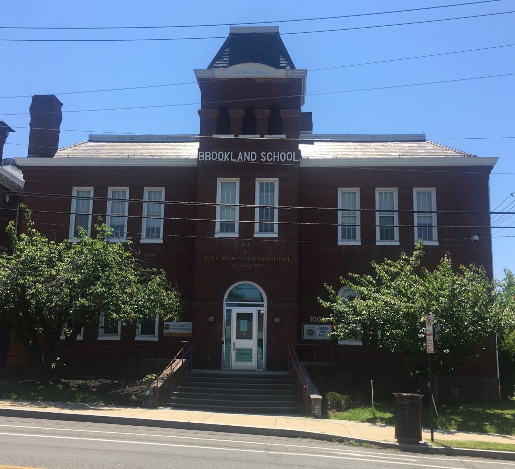
Marjorie attended the Brookland School, opened in 1891 for White students only. Today it houses Luke C. Moore Senior High School, and serves primarily African American students. In 1909, the Brookland School became the focus of a major story about race relations.
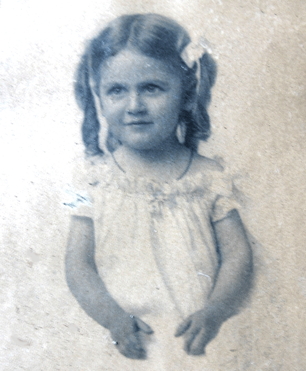
Isabel Wall was seven years old when she enrolled at the Brookland School. Only a few days later she was kicked out, because rumors had reached the principal that Isabel’s father, Stephen, although light-skinned and married to a White woman, was in reality a Black man. He decided to fight the ruling and brought the school to court. It soon became a national story.
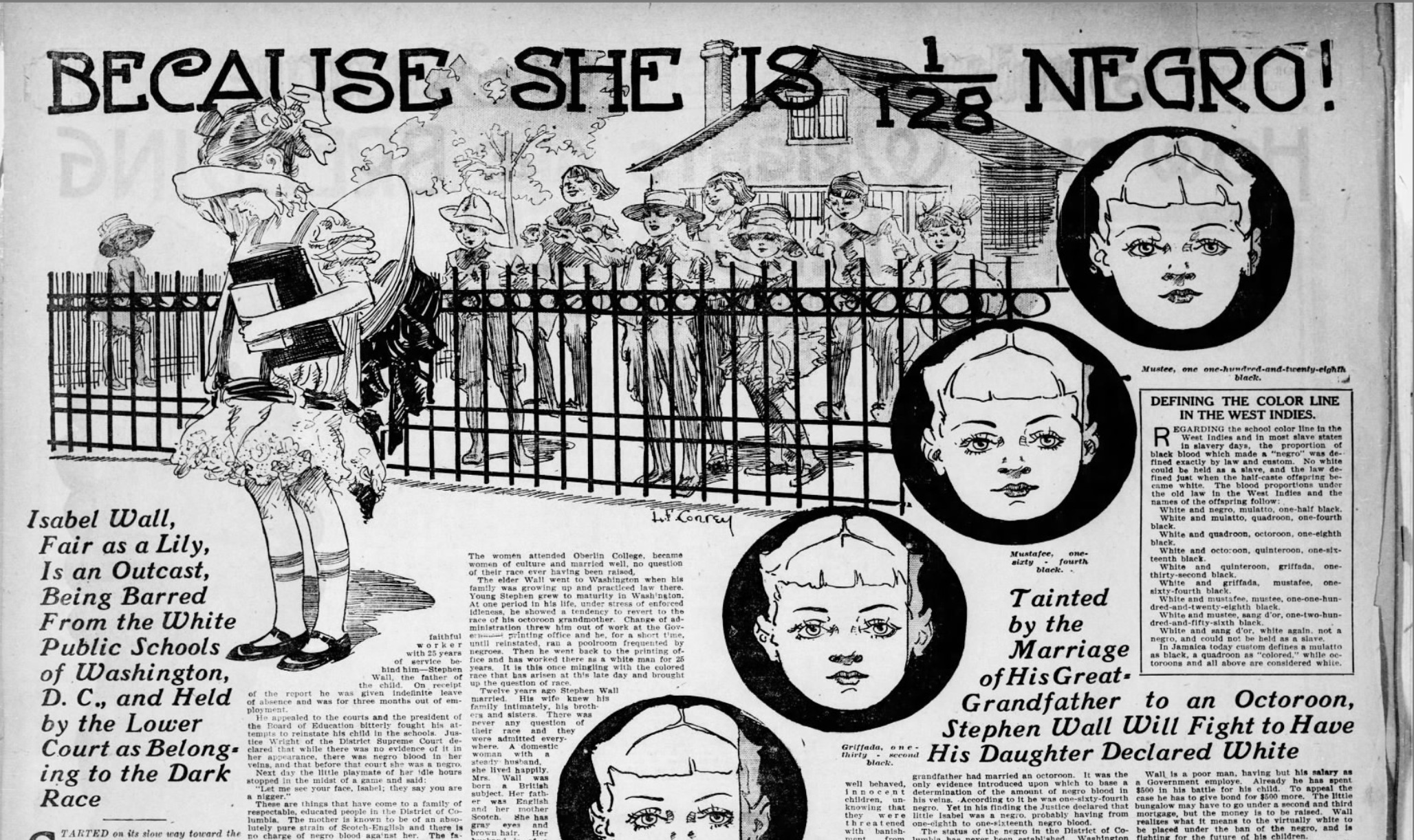
Wall lost the court case, which ruled that Wall’s grandmother was an enslaved Black woman, and so even his White-complexioned daughter was considered tainted, according to the “one-drop” rule, prevalent at the time. Rather than submit, Wall changed the family name, left Brookland, eventually landing in Georgetown, where he sent his daughter to a White school. The rumors about Stephen Wall that started the whole case came from the Brookland Citizens Association. Although they did many positive things to encourage the growth of the neighborhood, they also worked very hard to keep it as White as possible, and would continue to do so in the coming years.
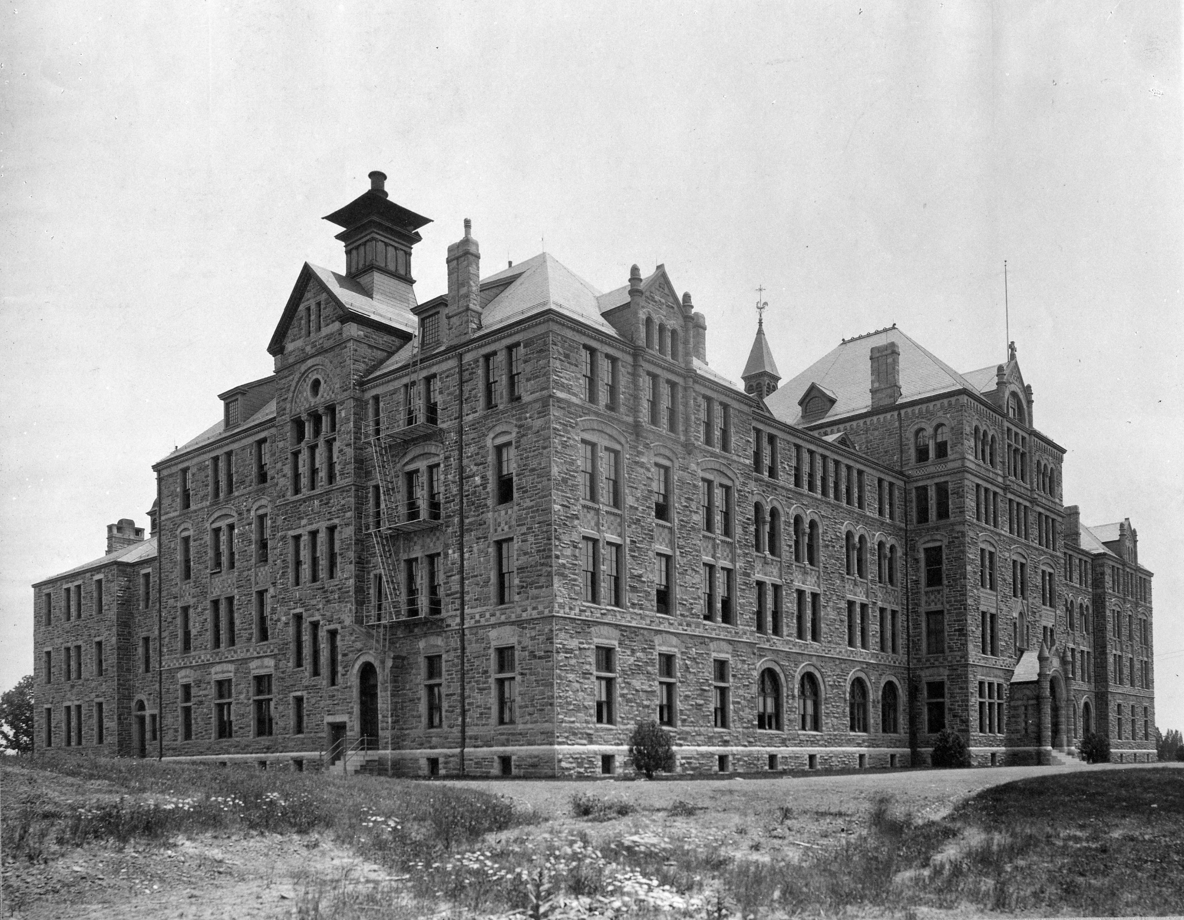
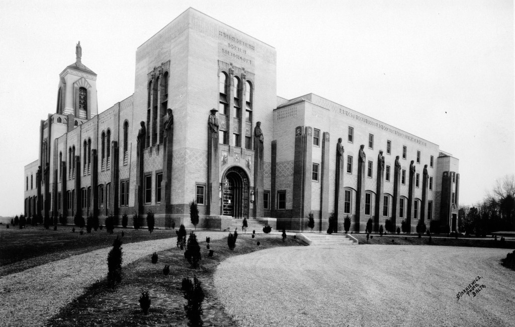
While Brookland was developing, so was The Catholic University of America. This is Divinity Hall, later renamed Caldwell Hall, the first building constructed on the campus, in 1888. Originally just for graduate level religious men, it soon included laymen, and then in 1904, undergraduates. All the while, the university was encouraging Catholic religious orders around the country to affiliate with them and set up seminaries, monasteries, and houses of study nearby. They did, in droves. Franciscans, Dominicans, Paulists, Marists and many more bought land in Brookland or nearby and built some impressive structures to house their communities. Here are a few:
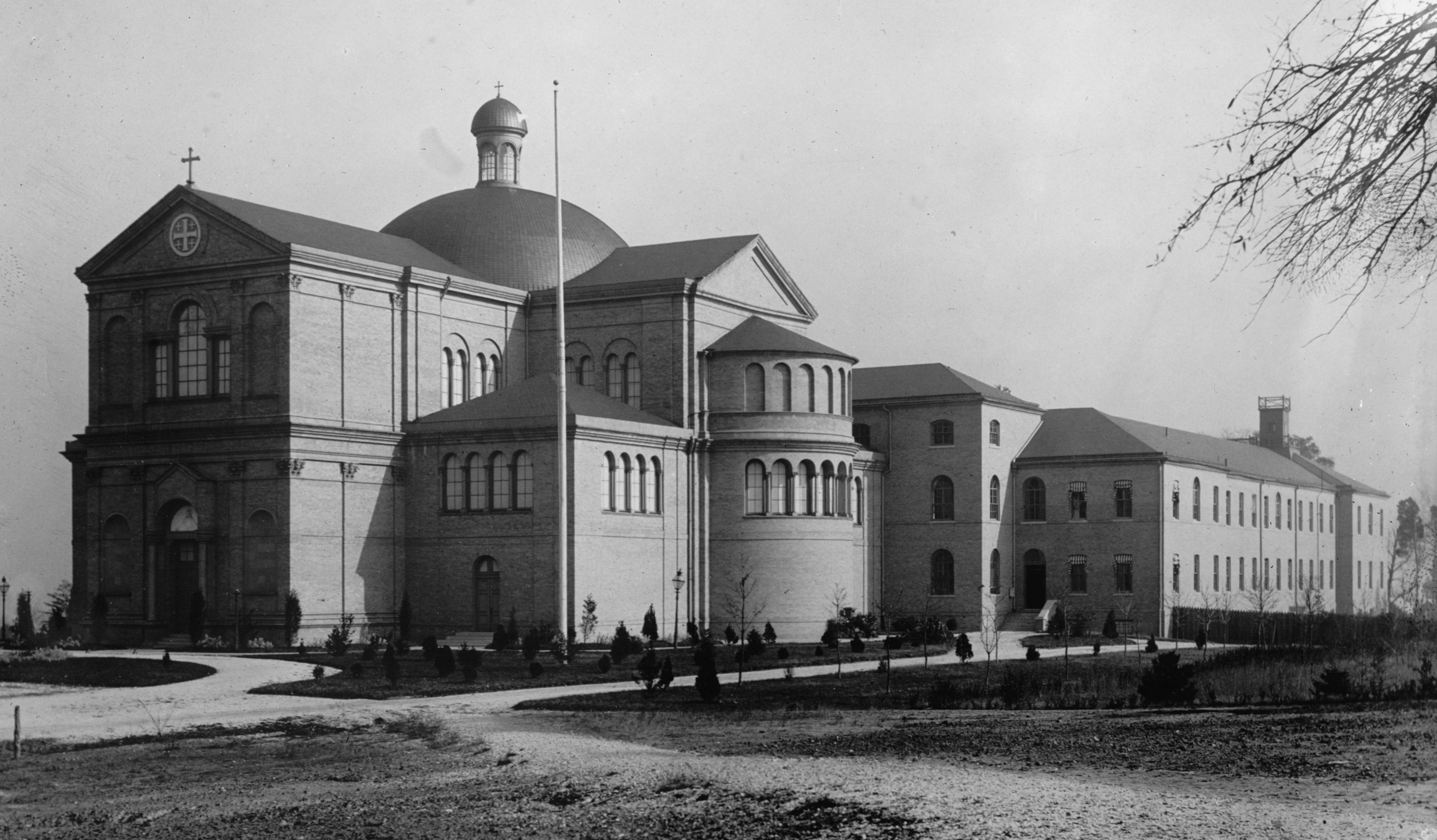
This is the Franciscan Monastery, shortly after it was constructed in 1899 at what is now 14th and Quincy Streets. The building and the beautiful gardens that surround it have become an important part of the neighborhood.
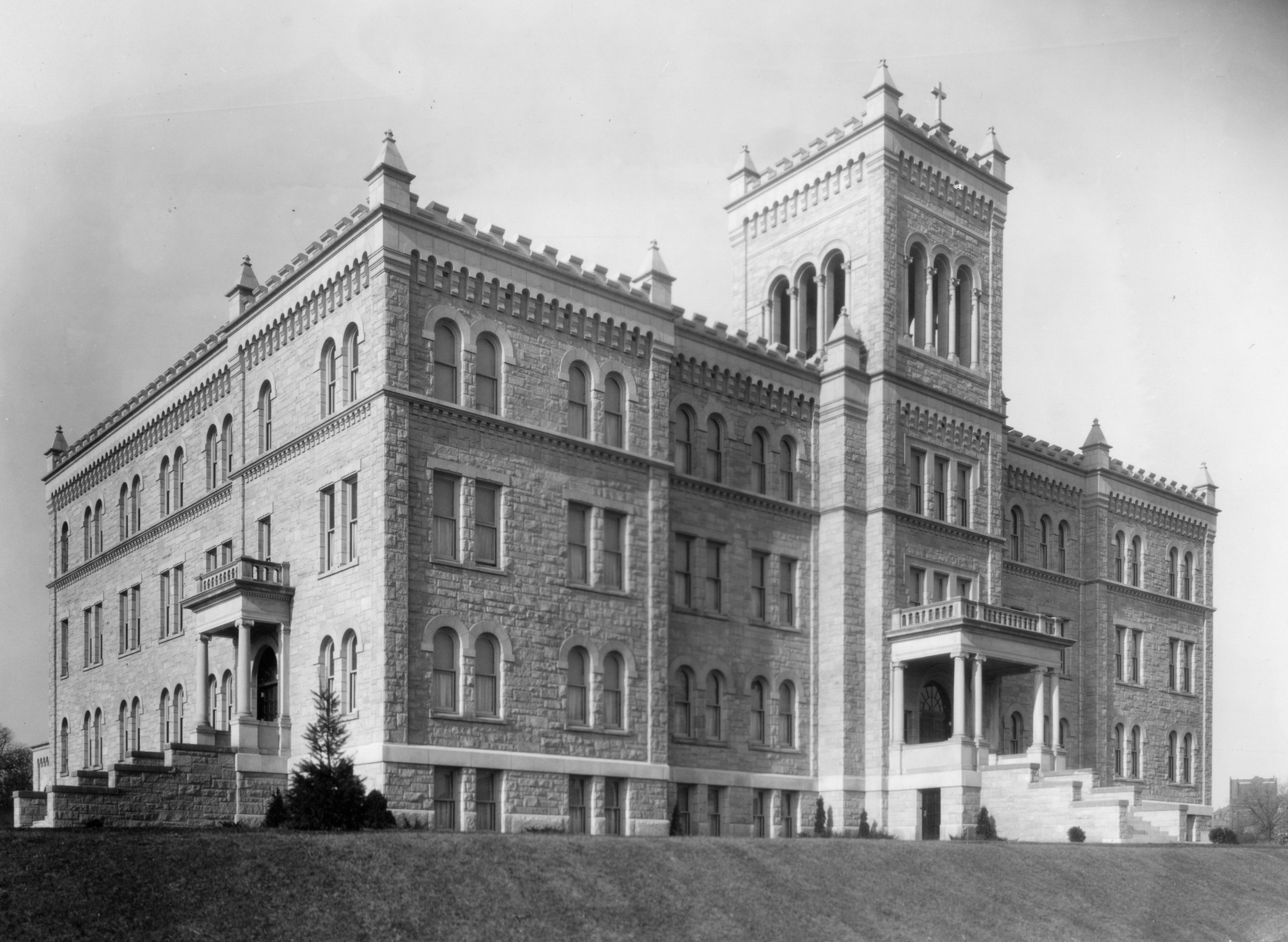
The Redemptorists affiliated with Catholic University, and built Holy Redeemer College on 7th Street. They’ve now sold off some of the land surrounding this beautiful building for townhouse development.
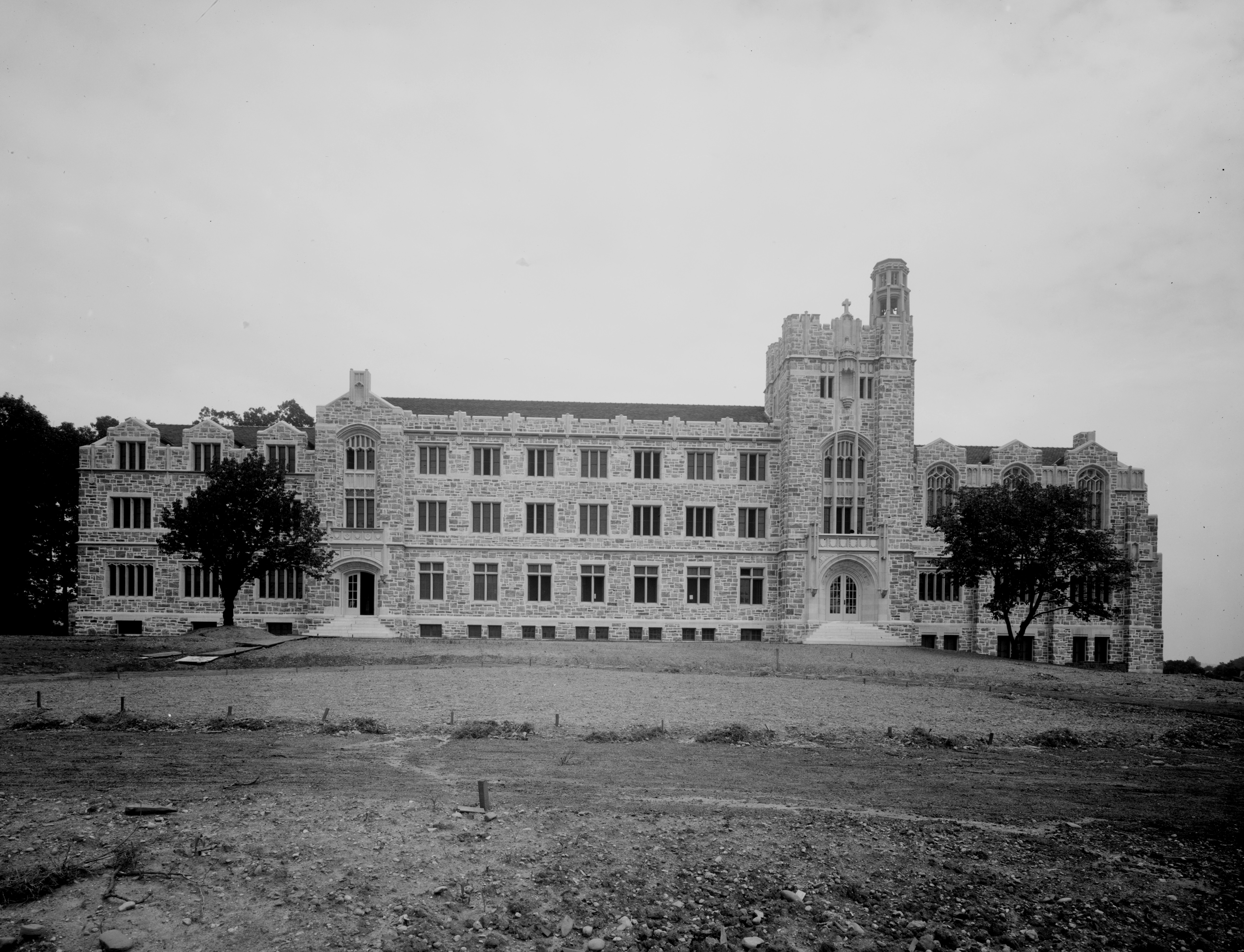
Just west of Holy Redeemer is St. Paul’s College, built by the Paulists in 1914. They too have sold much of the surrounding land they owned, which is being rapidly developed.

There were many more religious buildings, and hundreds of men and women in their religious garb on the sidewalks. No wonder the neighborhood was dubbed “Little Rome” by the media, though I’ve never heard a Brookland resident refer to it that way. But the Catholic presence did serve to draw many Italian, and especially Irish people to the neighborhood.
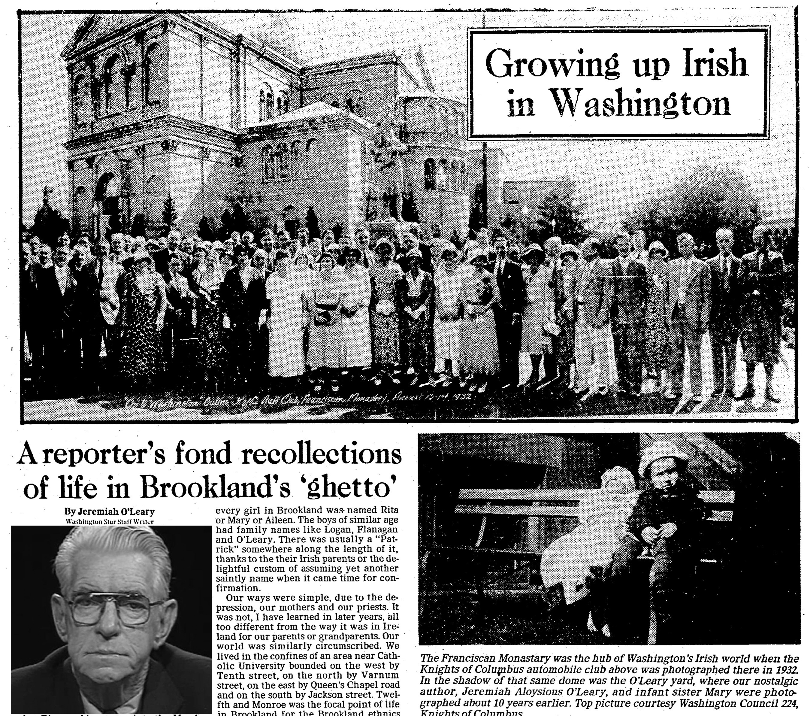
In the 1970s, Jeremiah O’Leary, a reporter for the Evening Star, wrote a nostalgic column about growing up in Brookland in the 1920s. “It was in every sense an Irish enclave,” he writes. “Dominated by the looming edifices of the Franciscan Monastery, CU, St. Anthony’s Church and most of us were as isolated as if there were high walls around the neighborhood. I never knew a black person in that long-ago time.” We’ll see how that would soon change.
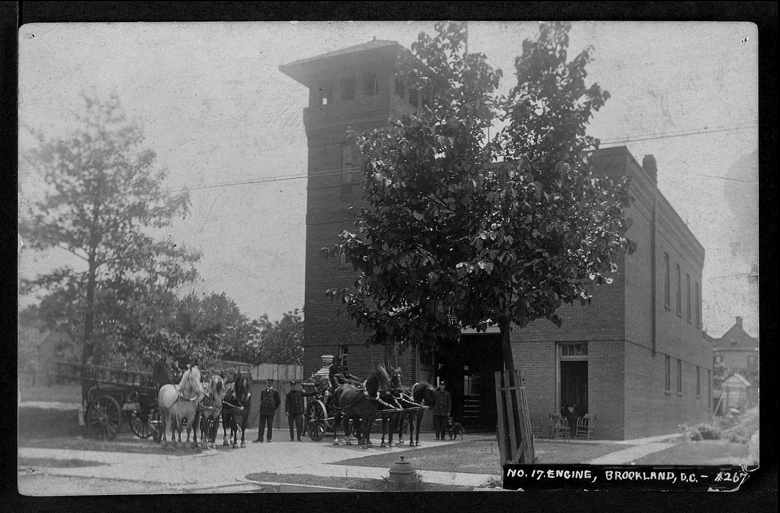
Infrastructure in Brookland kept pace. A fire house was built in 1902, first as a chemical company, and then when water service improved as Engine Company #17, which is still in service.
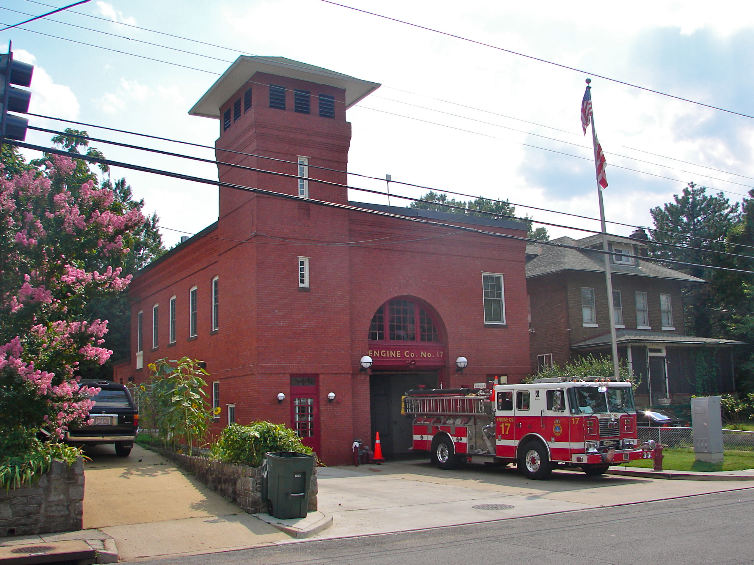
The 60 foot tower had two purposes – drying the hoses and serving as a watch tower. The building was named to the National Register of Historic Places in 2007.
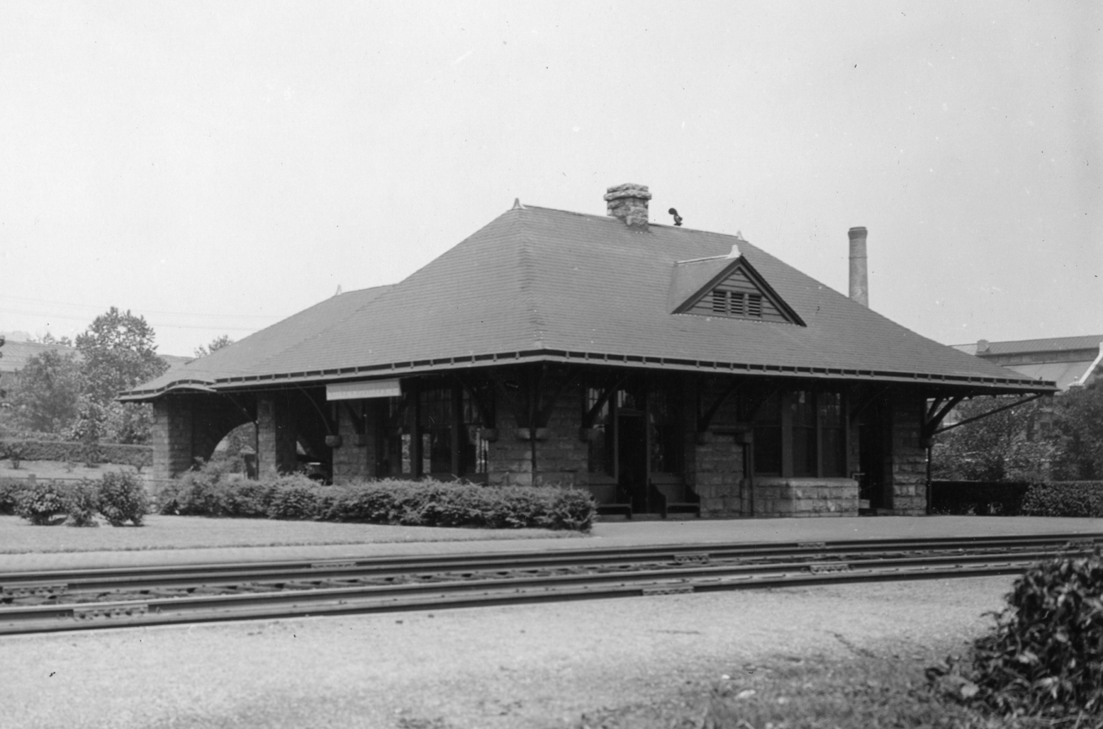
In 1890, Catholic University donated a narrow strip of land next to the railroad tracks at Bunker Hill Road for University Station to be built. This sturdy little granite building lasted for 80 years, until it was torn down to make way for the Brookland Metro stop. The railroad gave Brooklanders access to downtown, much faster than the painfully slow horse-drawn trolleys.
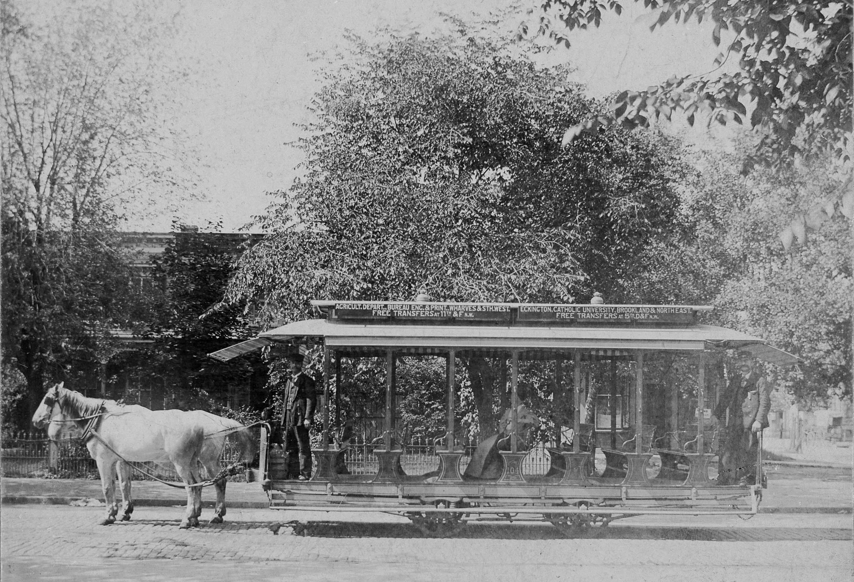
But as Brookland grew, it needed more mass transit. It needed an electric streetcar line.
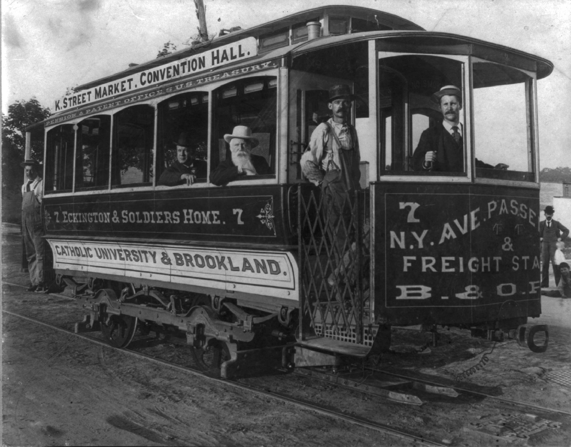
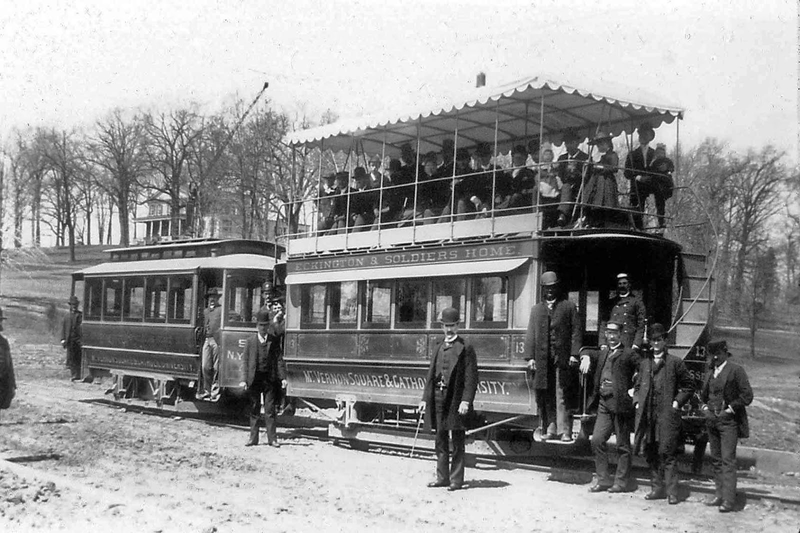
In 1889, George Truesdell had formed the Eckington Line and brought the electric streetcar up 4th Street to Catholic University. In 1894 the line was extended along Bunker Hill Road to the railroad tracks.
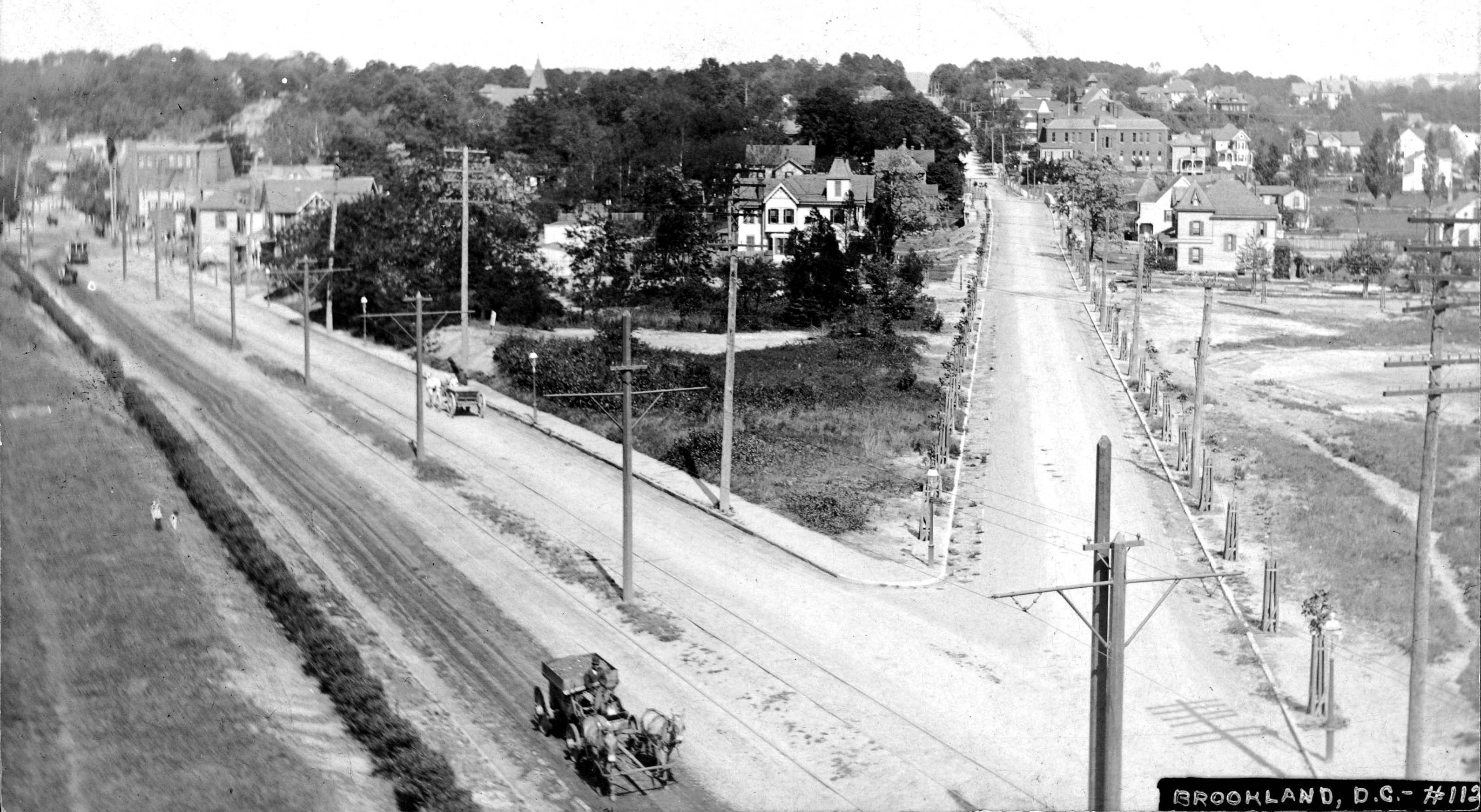
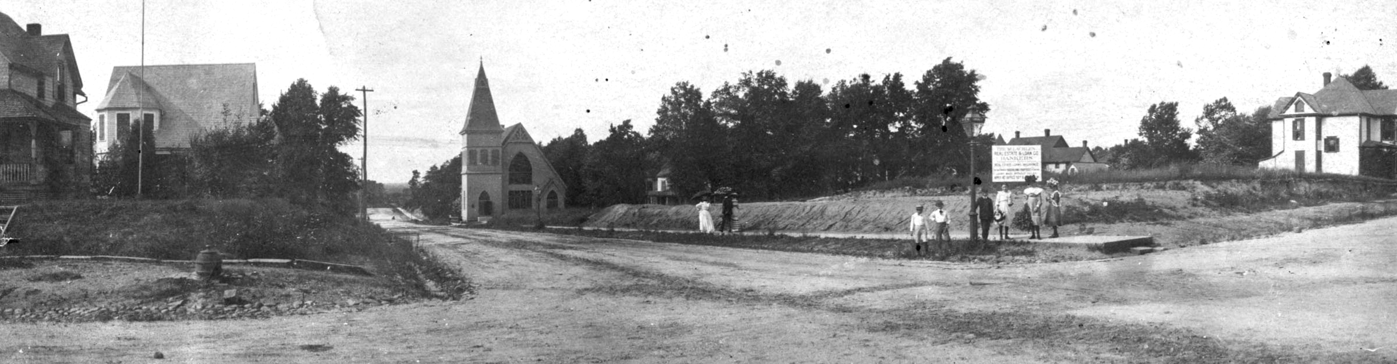
This is one of my favorite photos of early Brookland. You can see in this picture Bunker Hill Road, today’s Michigan Avenue, running downhill to the left. A streetcar is at the terminus by the rail crossing. But it couldn’t go across the tracks into Brookland. When a bridge was built over the tracks at Monroe Street, visible on the right, the situation changed. This photo was taken in 1909. Within a year the streetcar tracks would be torn up from Bunker Hill Road and laid down on Monroe Street, allowing access to the heart of Brookland.
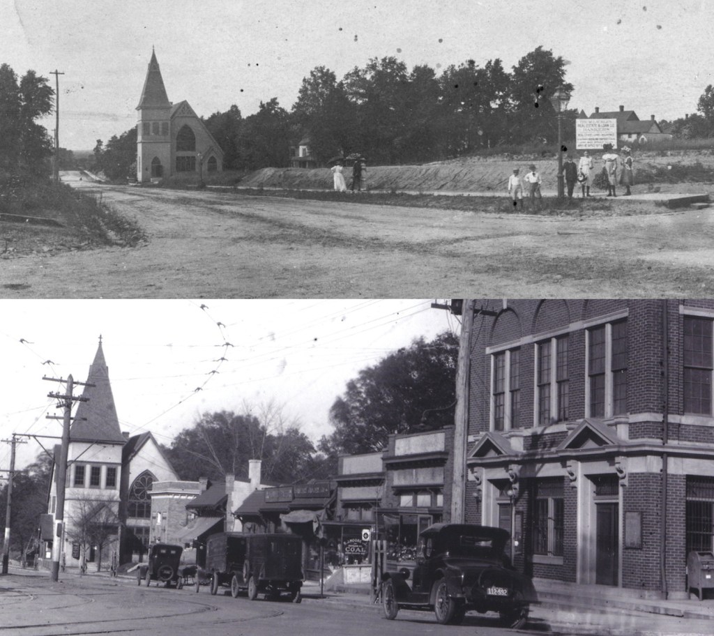
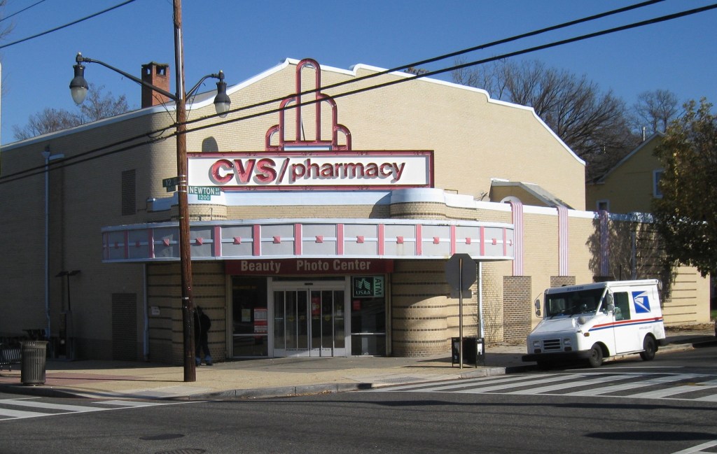
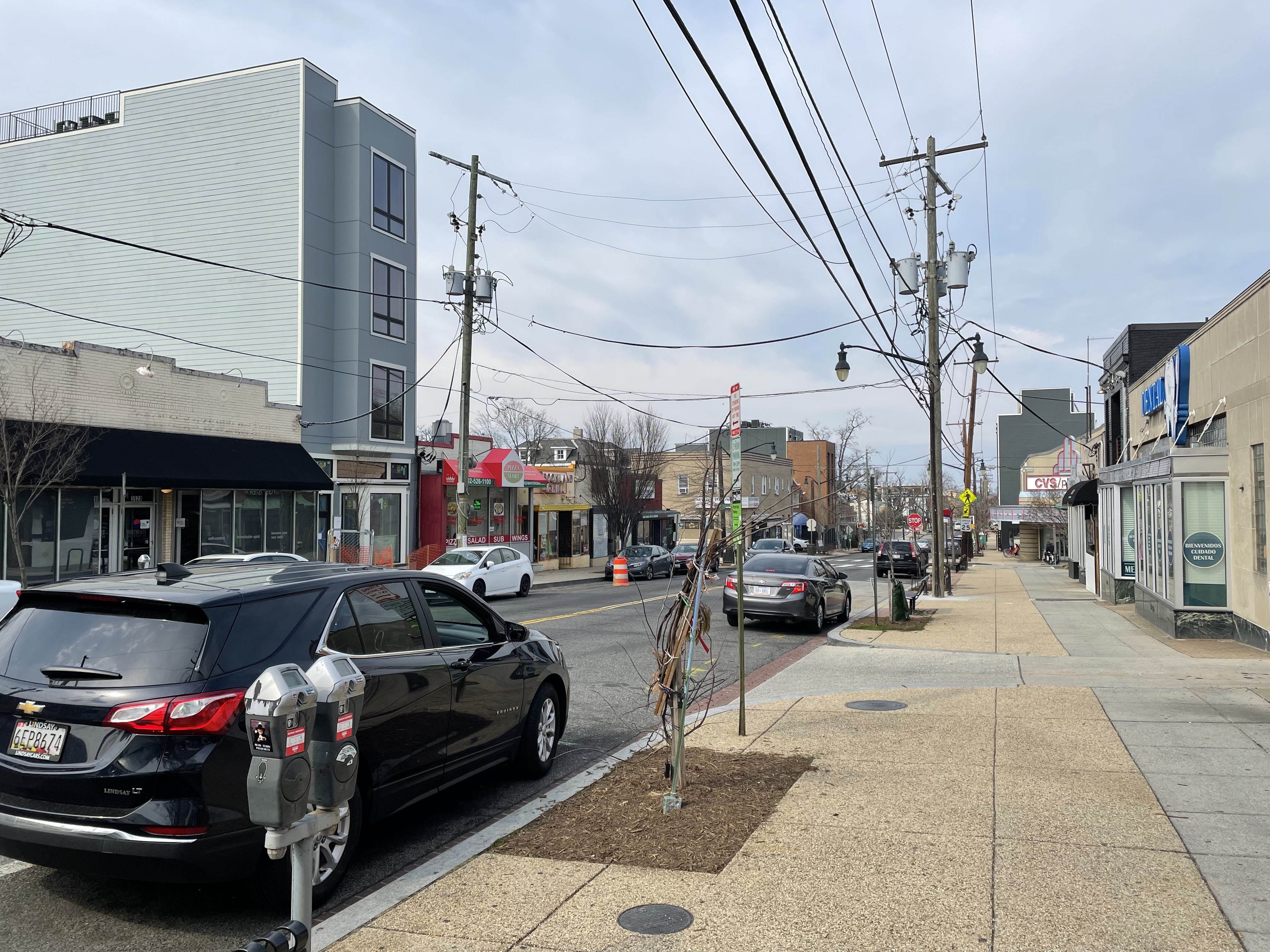
This photo shows the difference the streetcar made. At the top is the photo you saw earlier of a nearly empty 12th St. It was still that way in 1910 when the Monroe Street bridge first opened. The bottom photo is from 1925. Shops, a bank, a Masonic lodge, and a post office now line 12th Street, with the overhead streetcar wires making the turn from Monroe and heading north. The Brookland Baptist Church burned down in 1926. The church was eventually replaced by the Newton Theater, built by Jesse Sherwood. A local landmark, today it is a CVS.

Jesse Sherwood and his brother James were important developers in early Brookland. I live in one of their houses.
The streetcar brought in a lot of new people, turning Brookland into a real commuter neighborhood. Many of those new people were African American, including a substantial number of Howard University professors and administrators.
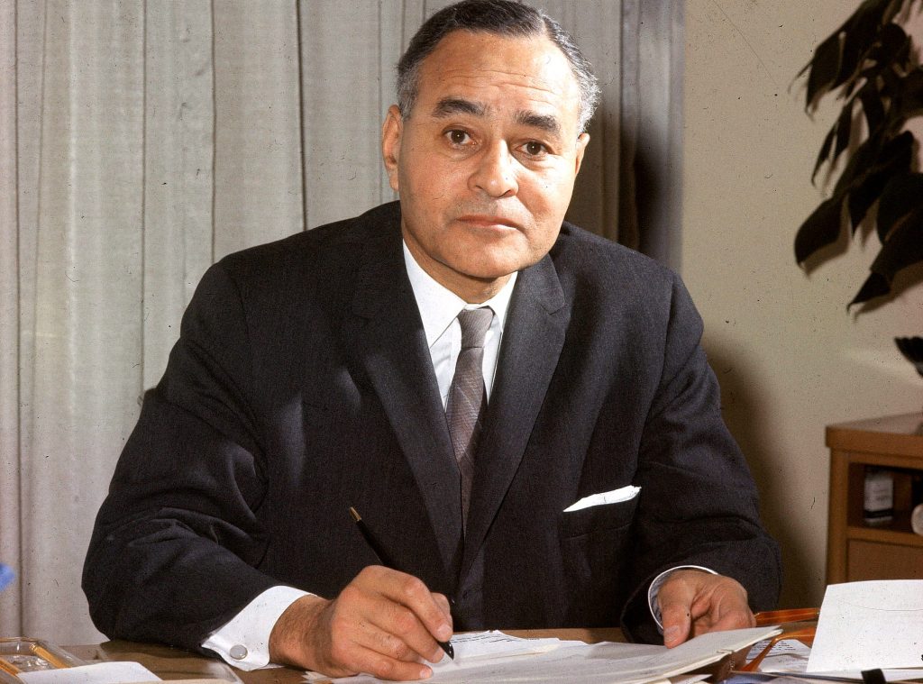
Ralph Bunche headed Howard’s Department of Political Science from 1928 to 1950. He also worked at the State Department, took part in the planning of the United Nations, and was deeply involved in attempts to resolve the Arab-Israeli conflict. For that he was awarded the Nobel Peace Prize in 1950, the first African American to be so honored.
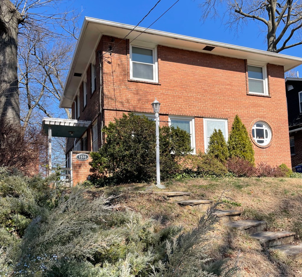
In 1941, he commissioned noted African American architect Hillyard Robinson to build a house in Brookland at 1510 Jackson Street. Designed in the International Style, it is a unique addition to the architecture of Brookland. The house still stands.
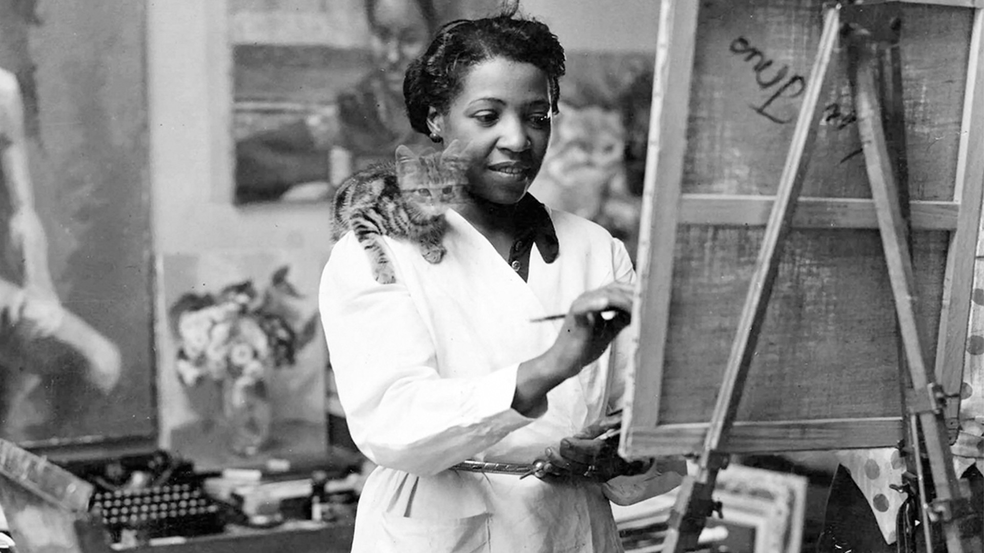
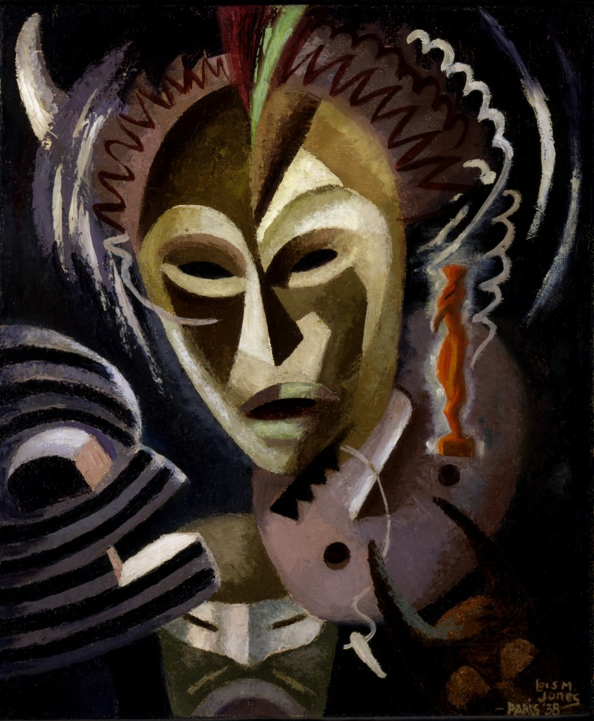
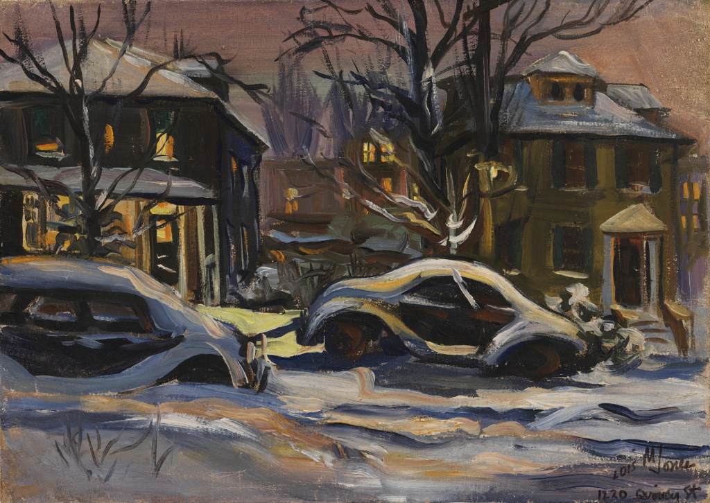
Lois Mailou Jones also taught at Howard University. For nearly fifty years, beginning in 1930, Jones taught art and design and would become an acclaimed international artist in her own right. Here are a few of her works:
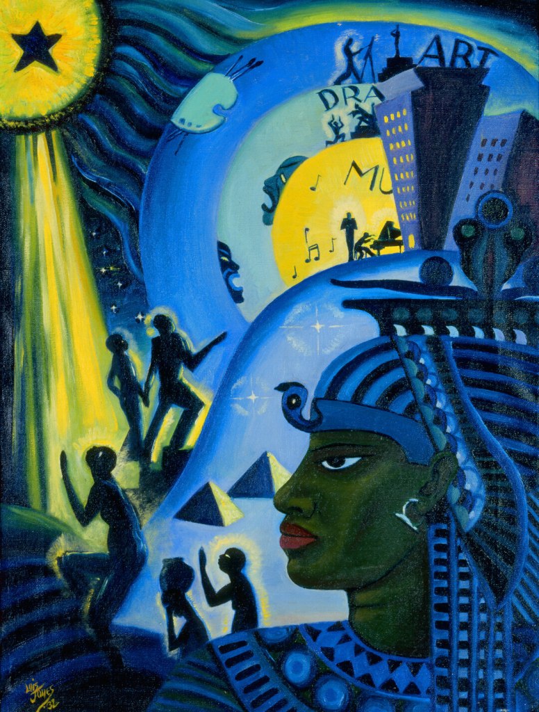
And this is titled “1220 Quincy Street,” her address in Brookland. But it isn’t a view of her home, it’s a view from her front porch. Those two houses across the street still exist.

When Jones moved here in the 1940s, she converted the attic level of the house to a studio. She called it the Little Paris Studio and brought in many artists of color to support and encourage.
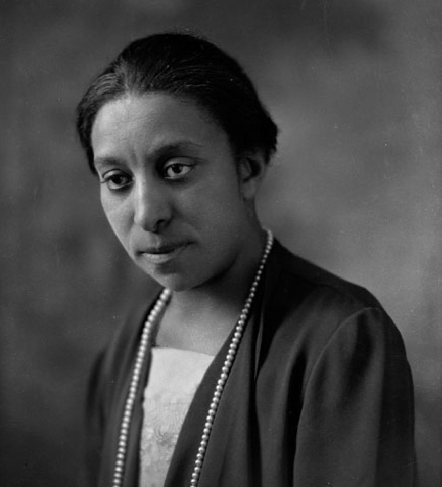
Lucy Diggs Slowe was the first Dean of Women at Howard University where she became a nationally-known figure in women’s education.
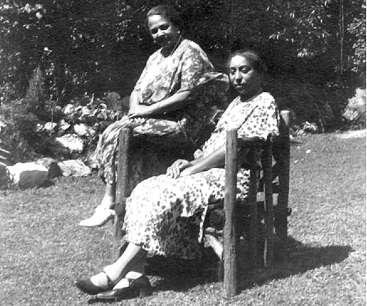
She lived at 1256 Kearny Street with her partner Mary Powell Burrill (on the left), a noted teacher of dramatics at Dunbar High.

Their house has recently been declared a historic landmark both for its association with LGBTQ history in DC, as well as for the educational accomplishments of both women.
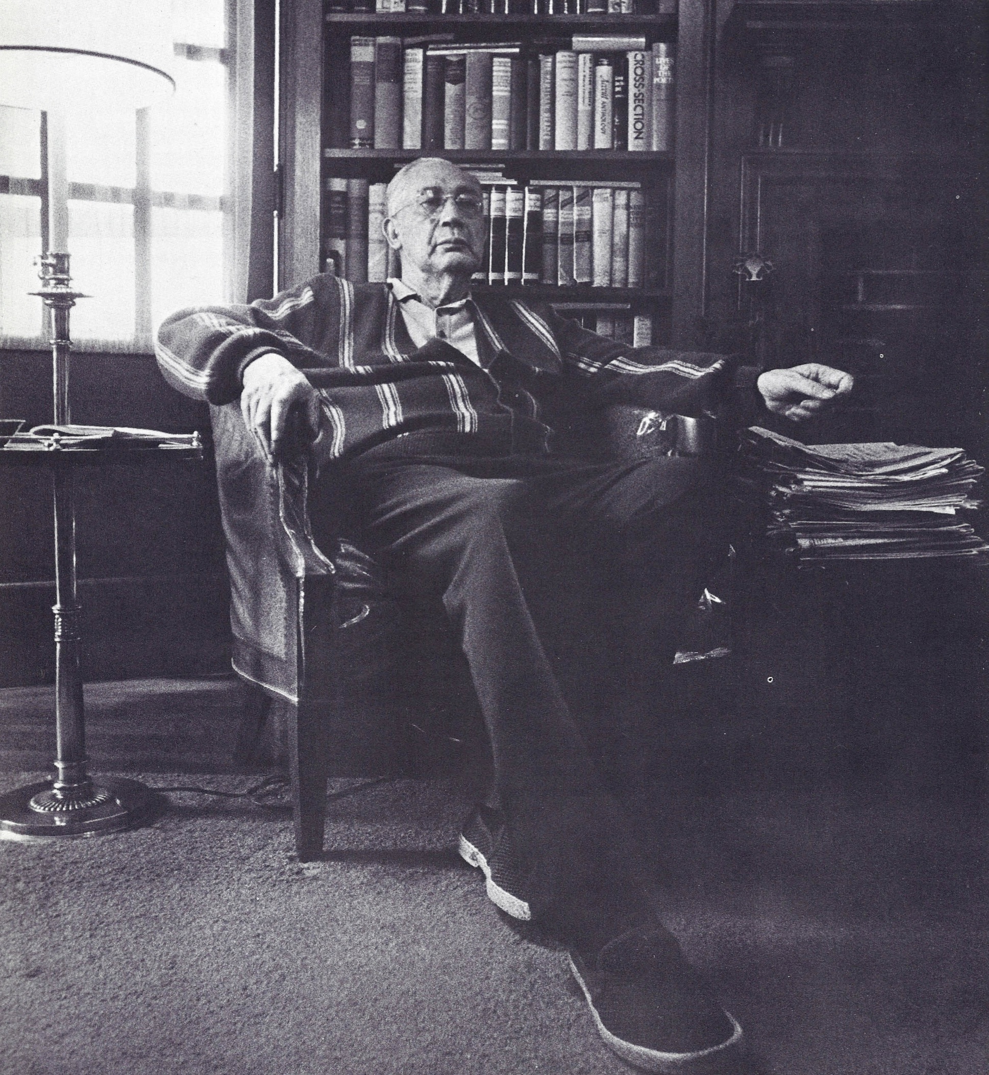
Three houses down from the Slowe/Burrill house is the home of Sterling Brown, a poet, literary critic and professor of American Literature at Howard University, beginning in 1929. He stayed there for 40 years, influencing generations of Black scholars.
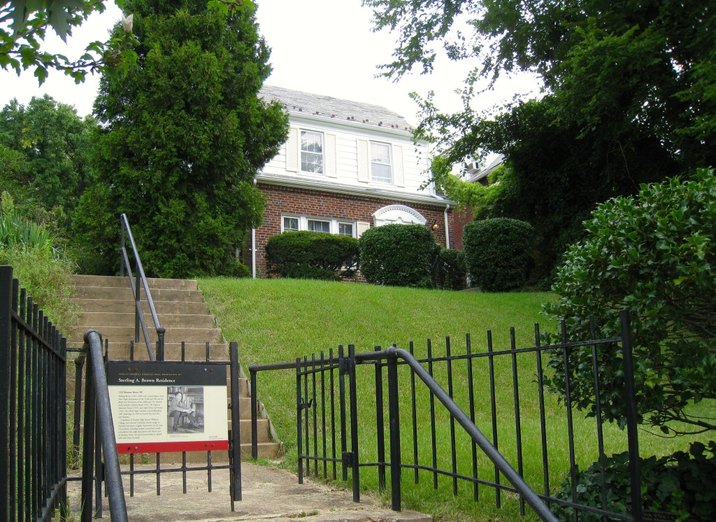
Brown lived in this lovely home, beginning in the 1930s, a time when there were few Black families in the neighborhood. Those families often had to deal with resistance to their presence in Brookland.
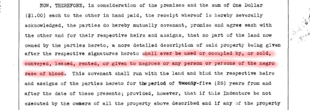
The Brookland Citizens Association was still fighting to keep Brookland White. In the 1920s, they began to use another tool – racially restrictive housing covenants. There were two types of covenants: those written into a home’s deed by the builders/developers; and those that used petitions, where neighbors gathered signatures to restrict an entire block, or multiple blocks. Covenants could last 25 years and prevented the owner from selling to a person of color.
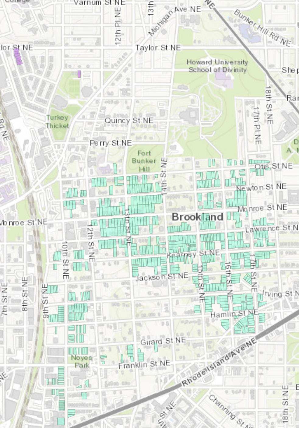
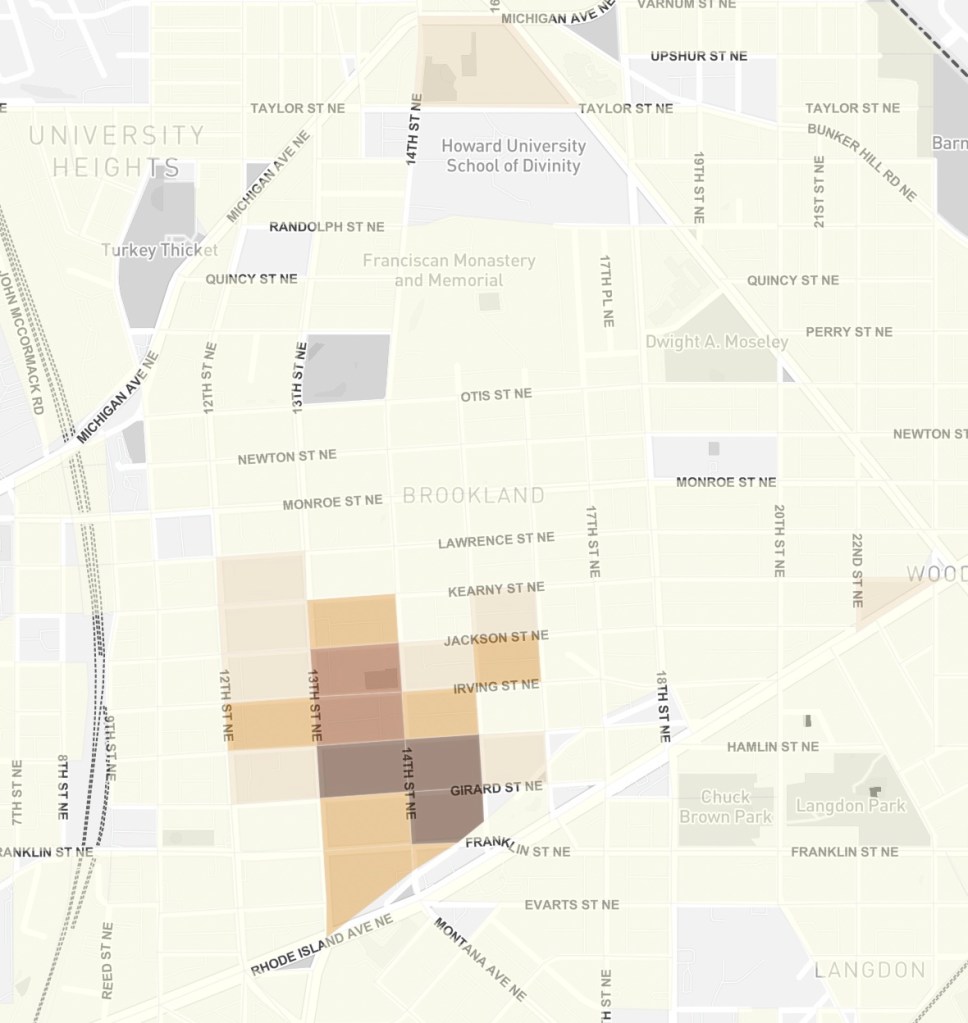
This map of Brookland, put together by the historians at Prologue DC, shows just how successful the campaign for petition covenants was. The green squares show where neighbors signed petitions to keep out Black families. As you can see, most of the families of color were restricted to the southwest part of the neighborhood.
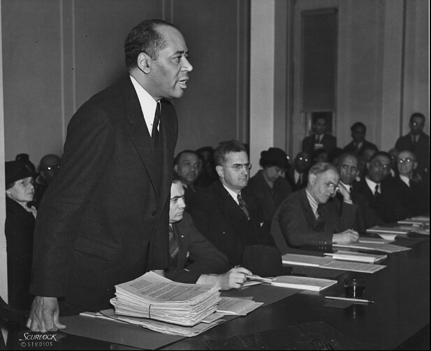
But African Americans pushed back against racial covenants and other segregationist policies. One of the first court cases against racially-restrictive covenants was brought in 1926 by Charles Hamilton Houston, then still a young lawyer, but soon to be the distinguished vice dean of Howard Law School and special counsel to the NAACP. But the Supreme Court declined to hear the case, allowing the openly racist covenant practice to continue.
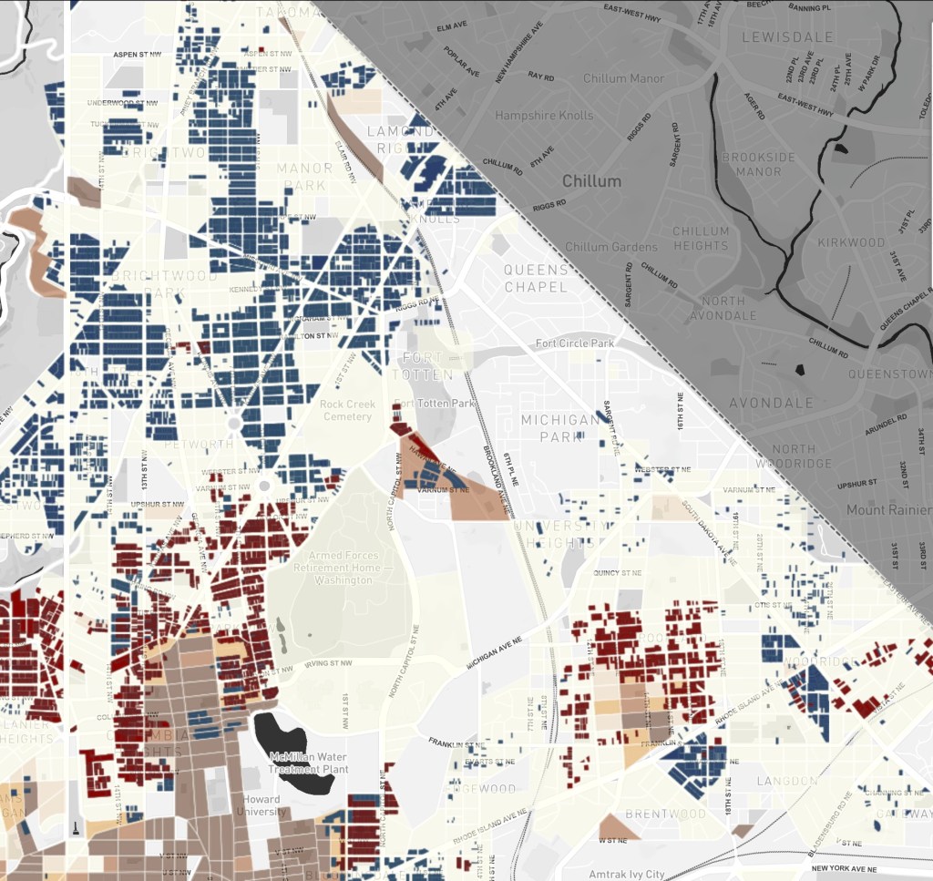
This wasn’t just a problem in Brookland, it was all over the city. Here’s a larger map from Prologue DC showing the covenants in the northeast part of the city. The dark blue squares are those restricted by deed, the maroon squares are those restricted by petition, and the light brown squares show where non-White households were living in 1940. It is easy to see how the covenants were used as a barrier to prevent so-called Black encroachment into their neighborhoods.

African American lawyers and others kept filing suits against covenants. They consistently lost those cases throughout the 1920s and ‘30s. But by the 1940s, the tenor of the country was changing and so were the courts. Finally the Supreme Court agreed to hear four connected restrictive covenant cases, and in 1948 decided that covenants were NOT legally enforceable. This changed everything.
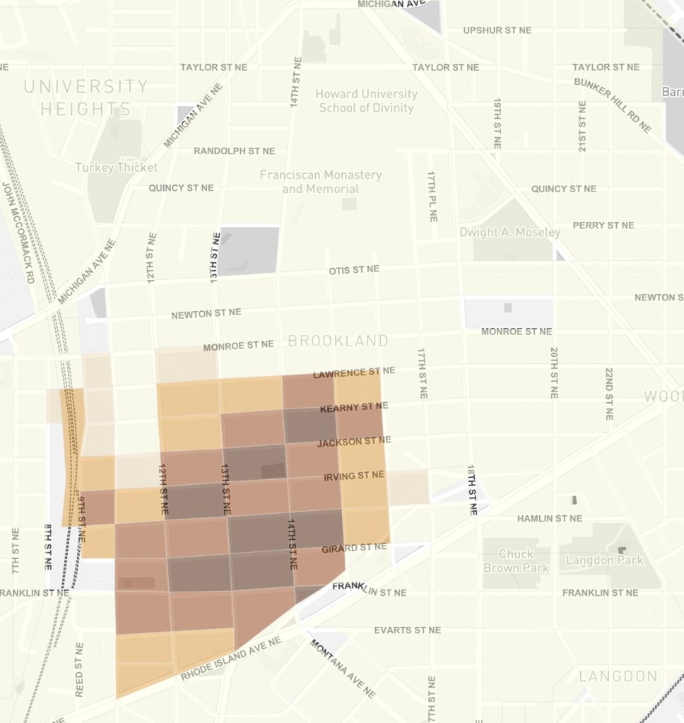
Take a look at these three maps of Non-White households in Brookland. First is 1940:
African Americans are restricted primarily to the southwest corner of the neighborhood.
By 1950, however, things were beginning to change.
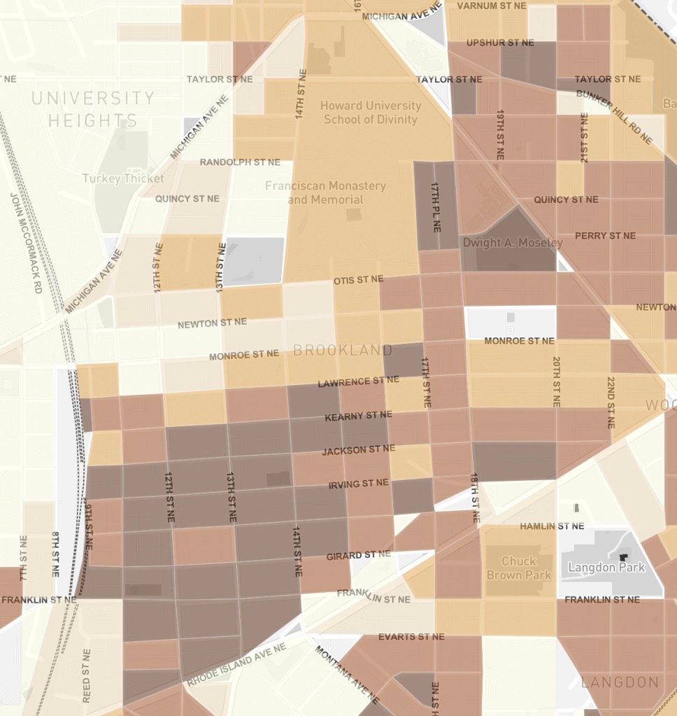
By the 1960s, the transformation was complete, and Brookland had become a majority Black neighborhood.
Of course, the more Black people moved in, the more White people left. The urban phenomenon of White Flight was abundantly apparent in Brookland. The Brookland Civic Association, started in 1941 as an alternative to the all-White Citizens Association, continued to grow, while the Citizens Association, having lost their biggest battle, withered away and disappeared in the 1960s.
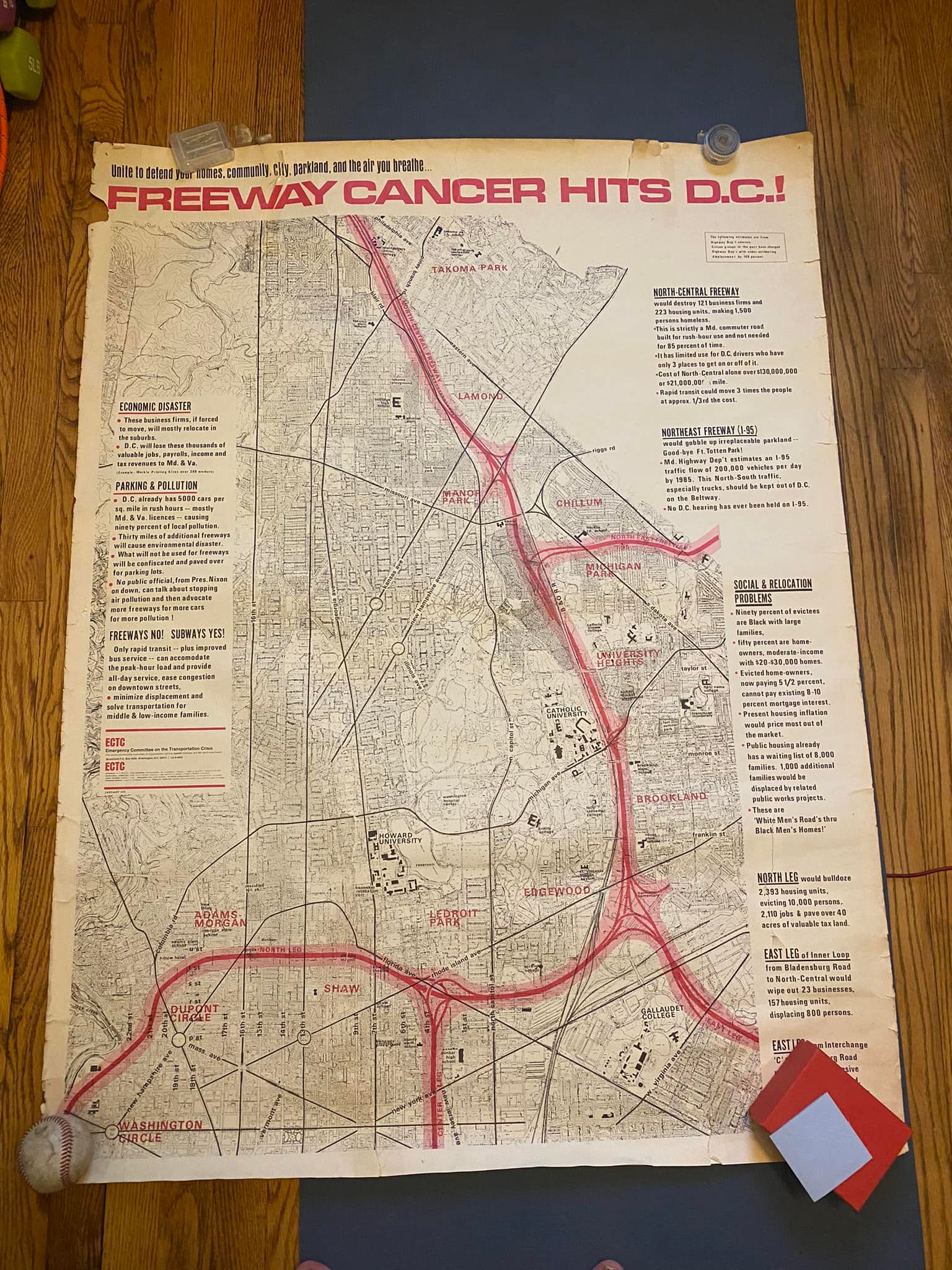
With so many moving to the suburbs, city planners decided new highways were necessary to allow those suburban dwellers easy access to downtown. However, those new roads would destroy many homes, particularly those of African Americans, and resistance grew quickly.
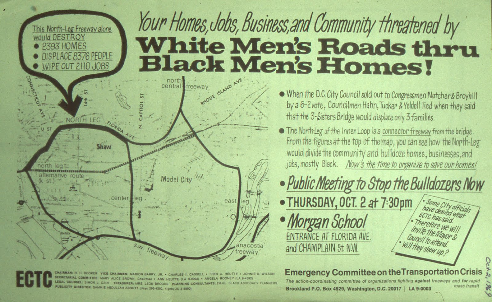
The Emergency Committee on the Transportation Crisis was a bi-racial activist group headed by Reginald Booker, and included many Brookland residents such as Tom and Angela Rooney, Fred and Anne Heutte, Douglas Moore, and many others.
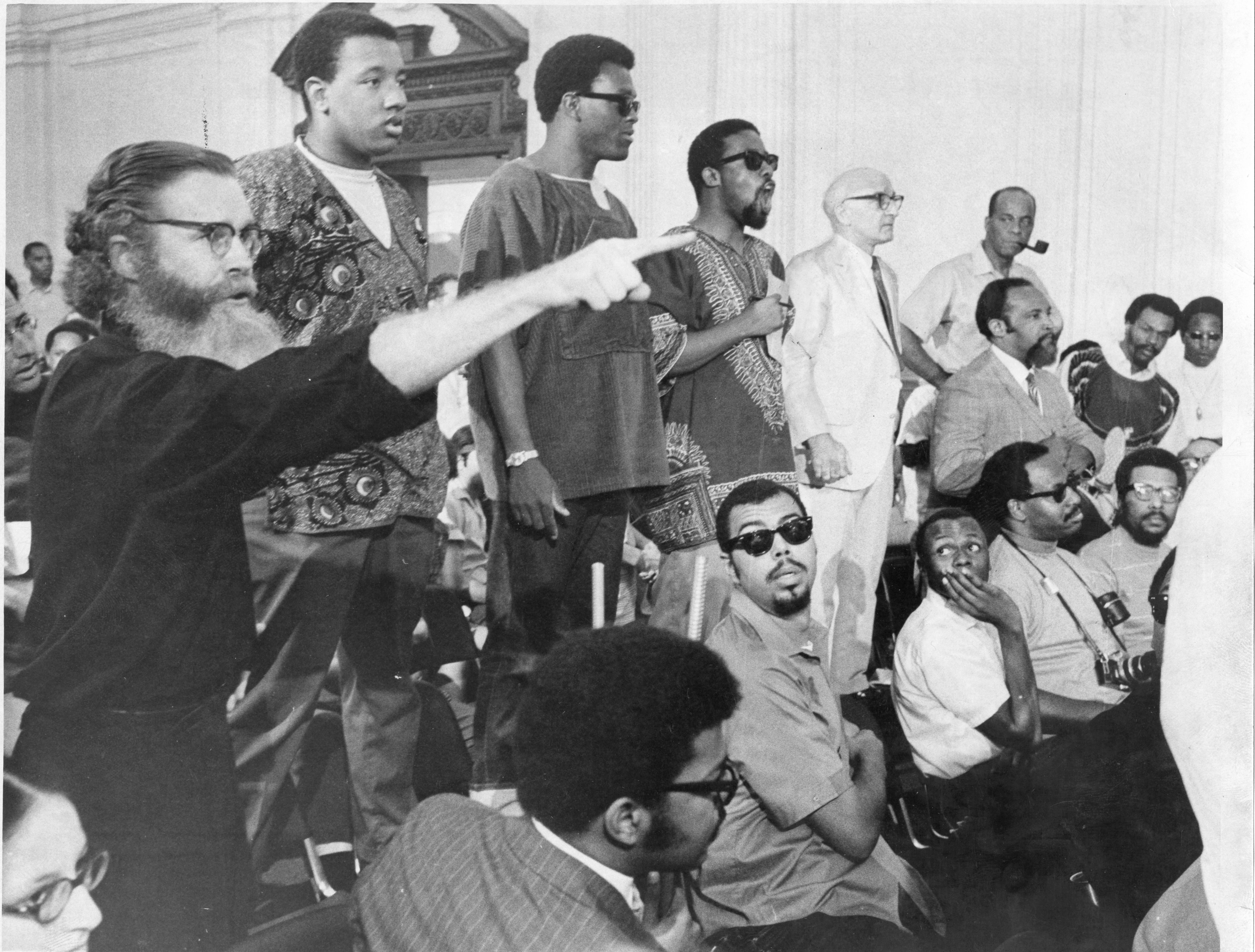
In this photo from 1969, members of the ECTC address the city council. Third from the left is Reginald Booker; fifth from the left is Sammie Abbott, publicity director and strategist, and future mayor of what we then called the People’s Republic of Takoma Park. Standing next to him with the pipe is Julius Hobson, a major DC activist and mayoral candidate, and seated below him to the right is Marion Barry. Booker was arrested shortly after this photo was taken.
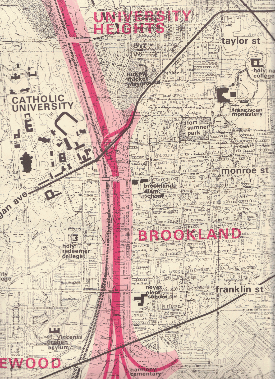
This map shows more detail about how the highway would have affected Brookland. The Brooks Mansion would be gone, all those houses between 9th and 10th streets would be gone. The separation between Brookland and Edgewood and Catholic University would be immense, isolating the neighborhood. Fortunately for us, the strong resistance to the plan bore fruit and the highway plans were dropped and funds diverted to developing a subway. Now you know why we have a Metrorail system and why Route 395 ends so inelegantly at New York Avenue.
In the following decades Brookland became a stable, comfortably integrated neighborhood. We’ve experienced a real spurt of growth in the last few years, which has up sides and down sides. There are numerous new developments that have brought and will continue to bring new people, housing, businesses, and services to the area. Many new restaurants and food emporiums have opened in the last decade, and most seem to be surviving the pandemic.
But that has come at a cost. The loss of green space hurts, especially in the summers when the whole area becomes a heat island. And more important, the cost of living here has increased dramatically, and some of the African American and other families who have been here for generations are finding it difficult to hold on. As the economy grows, so does gentrification, and the difficult problems it brings.
But in the end, what makes a successful neighborhood is a sense of community, of residents sharing pride of place and comfort with each other. Brookland has evolved over 135 years into a compassionate, feisty neighborhood, caring for neighbors when there is need, fighting the powers that be when necessary.
After 50 years, I’m still glad I live here.

Keeping true history alive is important especially in these changing times and the banning of some historical truths. The history you have here is greatly appreciated , thank you.
LikeLiked by 1 person
I grew up in Brookland, one of the Green family’s twelve children. Thoroughly enjoyed reading your account. One of our first family homes in the 1930’s was on Franklin St. near the train tracks. My older siblings remember waving to German POW’s being transported by train to camps.
I babysat for Angela and Tom Rooney mentioned in the highway fight.
My family’s presence in Brookland spanned from 1929 to 1993, mostly on Otis St, with strong ties to St Anthony’s and the Franciscan Monastery.
Thanks so much for this well researched history!
LikeLiked by 1 person
As a resident of nearby Michigan Park, I am very proud to call this section of the city home and I appreciate the rich history nestled right in our backyard. Would love to attend a forum on our neighborhood history at the newly redesigned Lamond-Riggs Library!
LikeLike
Thank you for your detailed history of Brookland. I was #5 of 7 boys that grew up there 1221 Newton Street. I played at Fort Totten, Bunker Hill & Old Soldiers Home. I lived there 1944-1959. I was born 1325 Jackson St. later the Lucy Diggs Slowe premises.
LikeLiked by 1 person